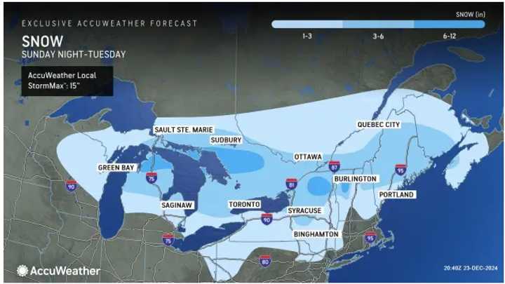
The time frame for the Alberta Clipper system is from the pre-dawn hours of Tuesday, Dec. 24 until late in the morning on Christmas Eve Day.
"A stripe of heavy snow will move along the northern tier of the region, but a smaller amount of snow and an icy mix will fall farther south," according to AccuWeather. "Travel hazards and delays are likely on the roads while airline delays mount due to deicing operations in the travel hubs from the Great Lakes to the Interstate 95 corridor of the Northeast."
"Roads will become snow covered due to recent cold weather, resulting in slippery travel conditions," the National Weather Service says. "Anyone planning to travel Tuesday morning should use extra caution."
For the latest snowfall projections, click on the map above from AccuWeather.
The first image shows a widespread 1 to 3 inches in the lightest shade of blue, with 3 to 6 inches forecast in areas shown in sky blue, and 6 to 12 inches in northern New York and New England in darker blue.
For a look at where slippery travel is expected and predicted precipitation types by location, click on the second image and third images above on the AccuWeather map.
Accumulating snow will quickly come to an end late morning Tuesday with temperatures rising into the middle and upper 30s in the afternoon.
Christmas Day will be sunny and brisk on Wednesday, Dec. 25 with temperatures generally just above freezing, but wind-chill values int he 20s.
It will remain dry with seasonable temps on Thursday, Dec. 26, and Friday, Dec. 27.
Check back to Daily Voice for updates.
Click here to follow Daily Voice Temple Hills-Camp Springs and receive free news updates.


