El Niño events, which usually form every three to four years, are triggered by warmer surface water in the equatorial Pacific Ocean, with warmer water leading to stronger El Niños.
In a report released this week, NOAA said "El Niño is anticipated to continue through the Northern Hemisphere winter," with a greater than 95 percent chance through January-March 2024.
There's a 30-percent chance, according to NOAA, that it could hit top-level "super" El Niño status, with a degree of strength that could result in severe weather, and a 71-percent chance it will be a strong El Niño.
The last time there was a "super" El Niño was 2015-2016. Traditionally, "super" El Niños have caused floods, fatal fires, and mudslides across the globe.
What does this mean for the US?
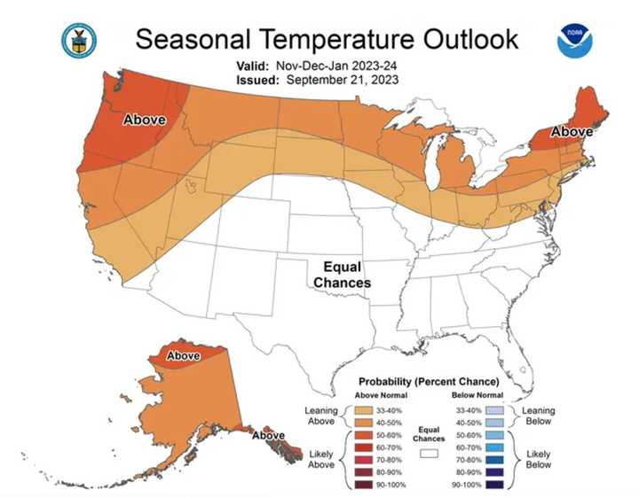
Expect warmer-than-normal temperatures for the Northeast - from New York and Pennsylvania through New England - and northern parts of the mid-Atlantic.
In the southern US, temps will be closer to average.
For a look at predicted temperatures through January 2024 from the NOAA Climate Prediction Center, see the first image above.
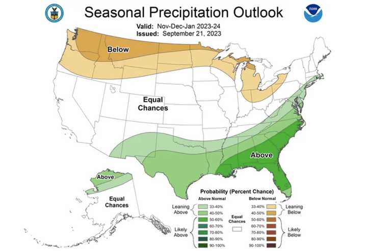
As far as precipitation goes, expect above-level amounts through January 2024 in areas shown in shades of green in the second image above.
Check back to Daily Voice for updates.
Click here to follow Daily Voice Bel Air and receive free news updates.

