The high temperature on Saturday, Feb. 18 will climb into the 40s in the afternoon, but strong winds will make it feel like it's in the 20s despite sunny skies, National Weather Service
A return to warmer-than-normal temperatures follows for Sunday, Feb. 19, Presidents Day on Monday, Feb. 20 through Tuesday, Feb. 21, as high temperatures will range from the upper 40s to low 50s with cloudy skies each day.
Showers are possible both Monday and Tuesday, with some areas seeing snow showers Tuesday morning.
The potent storm is then forecast to roll out from the western US, according to AccuWeather.com.
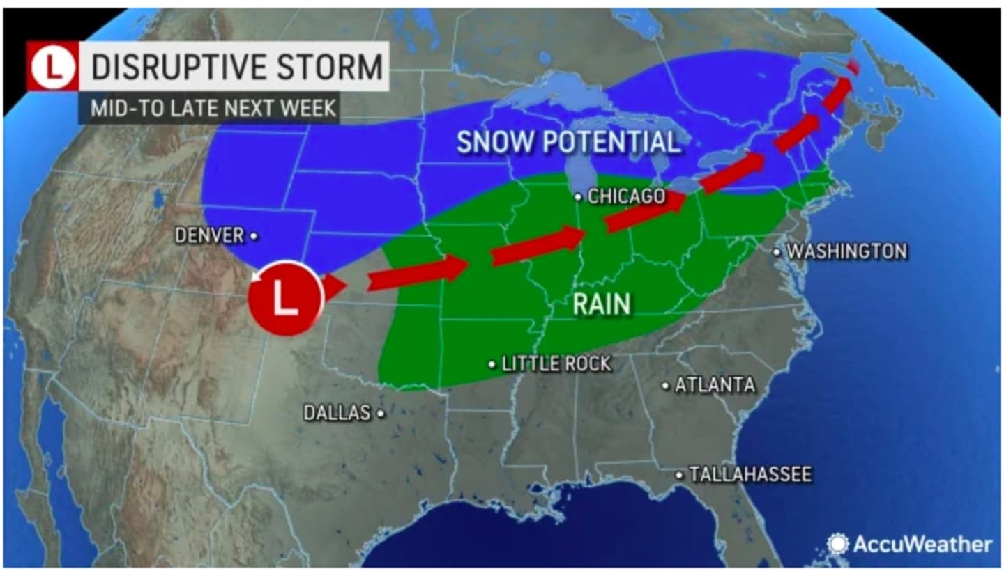
"While there is still some potential for the storm to track far enough to the south to bring snow or a wintry mix to cities such as Chicago, Detroit, Boston, and perhaps New York City, the recent trend in data suggests a more northerly path for the storm," AccuWeather Senior Long-Range Meteorologist Joe Lundberg said.
If it does take that track, most of this region will see rainfall from the storm Wednesday night, Feb. 22 into Thursday, Feb. 23. (See the image above.)
Since the storm is five days, there is uncertainty surrounding its potential strength, track, and timing.
Check back to Daily Voice for updates.
Click here to follow Daily Voice Worcester and receive free news updates.