The storm system arrived late Thursday night, Jan. 6, and is expected to push off the East Coast by around midday Friday, Jan. 7.
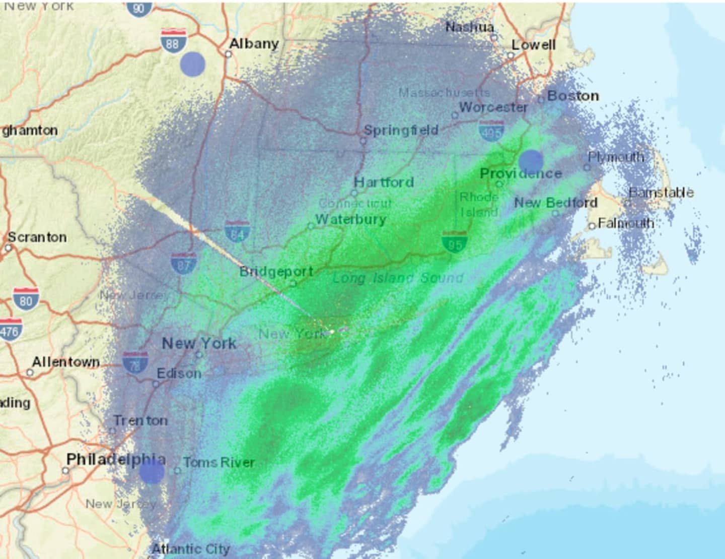
By 7 a.m. Friday, many areas had already reported seeing 6 inches of accumulations. In Columbia, Connecticut, located in Tolland County, 12 inches had already fallen by around daybreak Friday with the snow described as fluffy and picturesque.
Travel has become very hazardous across all area roadways and visibility is limited to around one-half mile in areas with heavy snow bands, the National Weather Service said.
A Winter Weather Advisory is in effect until noon Friday, but the storm is expected to wind down by around 9 a.m. in the New York City area, 10 a.m. in Hartford, and around noontime in Boston.
Generally, between 5 and 6 inches of snowfall is now expected, up from the previous prediction of 3 to 5 inches prior to the storm's arrival.
Check back to Daily Voice for updates.
Click here to follow Daily Voice Hampshire Franklin and receive free news updates.