

There will be more snow at times during that stretch, but sleet and ice could pose more significant threats, with the possibility of potentially major power outages from damage to utility lines and trees as well as treacherous travel.
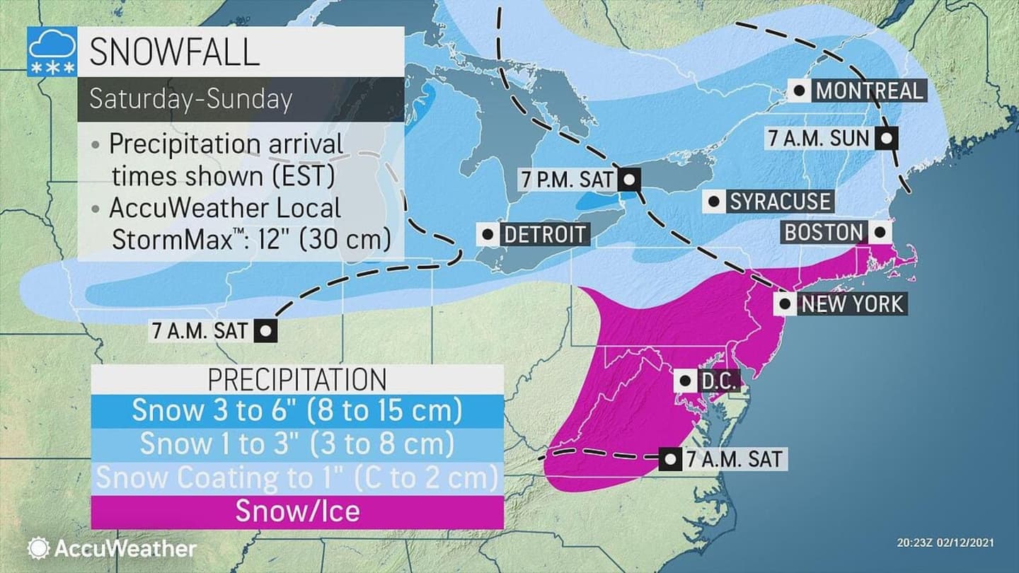
There will be a chance and snow and sleet Saturday evening, Feb. 13 through the overnight into Valentine's Day on Sunday, Feb. 14 as a storm system arrives. New snow and sleet accumulation of one inch and ice accumulation of one-tenth of an inch is possible. (See the first image above.)
A Winter Weather Advisory is in effect from 6 p.m. Saturday to 10 a.m. Sunday for much of the region. More advisories for elsewhere in the region could follow.
"This light precipitation can be every bit as dangerous to drive and walk on as a major storm, and motorists and pedestrians should be on the lookout," AccuWeather Lead Storm Warning Meteorologist Joe Bauer said.
Sunday, Feb. 14 will start out slippery, with a chance of snow, freezing rain, and sleet, through late in the morning on a cloudy day with a high temperature in the low 30s and wind-chill values in the 20s.
There could be a new round of rain, freezing rain, and sleet continuing before midnight, then a slight chance of freezing rain after nightfall into about midnight.
There will be freezing rain at times on Presidents Day on Monday, Feb. 15, which will be mostly cloudy with a high temperature hovering around the freezing mark. (Click on the second image above.)
Freezing rain will mix with sleet overnight and continue at times through the day on Tuesday, Feb. 16, with the potential for 1 to 3 inches of snowfall for areas north of I-84 in New York, Connecticut, and Massachusetts. (Click on the third image above.)
Check back to Daily Voice for updates.
Click here to follow Daily Voice Hampshire Franklin and receive free news updates.