

The timeframe for the storm is overnight Thursday, Jan. 6, into Friday, Jan. 7.
A general 2 to 4 inches of accumulation is now expected, including in areas as far south as New York City and Long Island, the National Weather Service said in a Hazardous Weather Outlook Statement released late Wednesday afternoon, Friday, Jan. 5.
"The snowfall is expected to impact the Friday morning commute," the statement said.
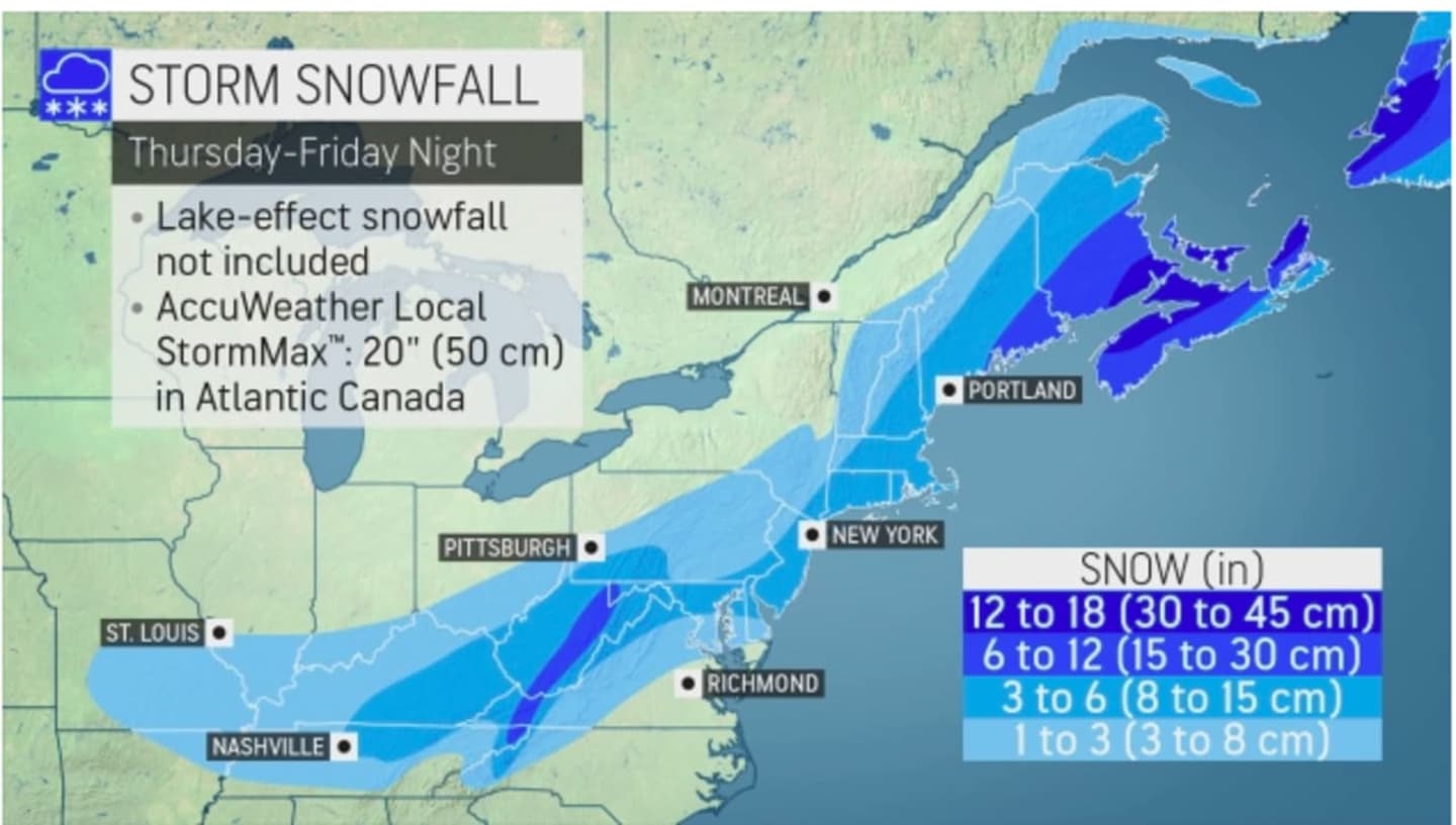
Much of the region could see as much as 6 inches of snowfall, according to AccuWeather. (See the first image above.)
For a look at the areas (in darkest blue) where the heaviest snow is expected, click on the second image above.
Thursday will be partly sunny with a high in the upper 30s before the storm is expected to arrive overnight, sometime around 1 a.m. Friday and continue into mid to late Friday morning.
There's still some uncertainty surrounding the precise track and timing of the storm. Check back to Daily Voice for updates.
Click here to follow Daily Voice Hampshire Franklin and receive free news updates.