
The time frame for the storm is from around nightfall on Presidents Day, Monday, Feb. 15 into mid-morning on Tuesday, Feb. 16.
A Winter Weather Advisory is in effect for the entire region from 7 p.m. Monday until 10 a.m. Tuesday.
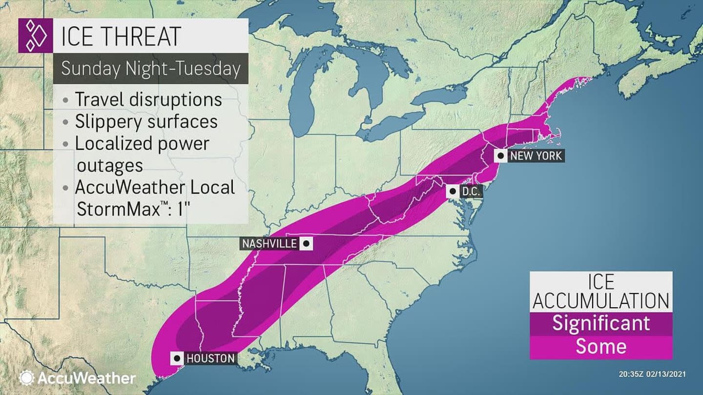
The greatest chance of widespread ice accumulation will be north and west of New York, including Orange County, where an Ice Storm Warning will be in effect from 6 p.m. Monday to 10 a.m. Tuesday, with a half-inch of ice accumulation likely, resulting in significant tree damage and power outages.
Freezing rain is expected throughout the Northeast overnight with ice accumulations of up to two-tenths of an inch.
Motorists should plan on slippery road conditions, the National Weather Service said.
Presidents Day will be cloudy with a high temperature in the low 30s and wind-chill values between 20 and 25. There will be periods of light snow and sleet at times during the day.
Freezing rain and sleet are expected to become widespread around nightfall Monday and continue into the overnight.
There will be a mix of snow, sleet, and freezing after daybreak on Tuesday before precipitation will change to all rain as the high temperature rises to the mid 40s on a cloudy day.
There will be a bit of break from the wintry precipitation Tuesday night into Wednesday, Feb. 17, which will be mostly sunny and cold, with a high temperature around 32 degrees.
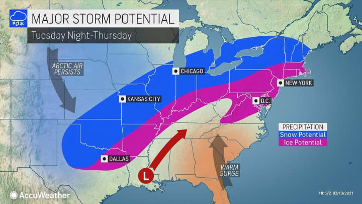
Clouds will thicken overnight Wednesday ahead of the next possible storm system on track to arrive sometime around midday Thursday, Feb. 18, moving from the midwest to the East Coast.
The chance for snow and sleet continues through Thursday evening and into early Friday morning, Feb. 19.
It's too early to project possible snowfall totals due to uncertainty surrounding the track, duration, and strength of the system.
Check back to Daily Voice for updates.
Click here to follow Daily Voice Hampshire Franklin and receive free news updates.