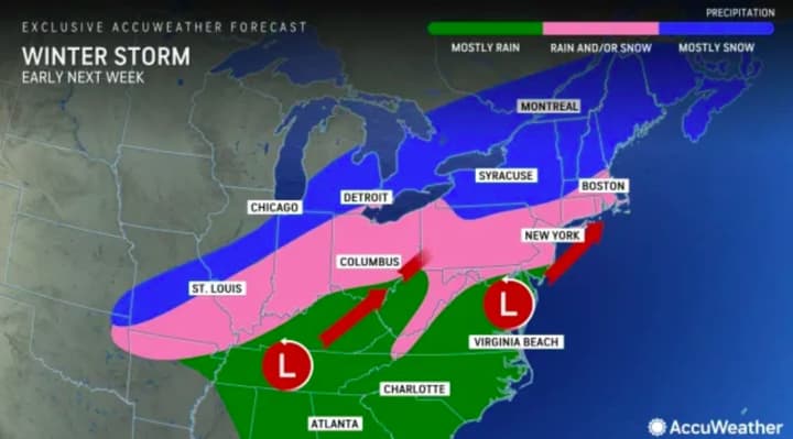
The above model shows rain and/or snow taking aim at most of Pennsylvania, New Jersey, and northern Maryland early next week, likely sometime Monday, Feb. 12 into Tuesday, Feb. 13.
"While the January thaw and break from the stormy pattern extended into early February, there is going to be a change in the pattern with a potentially impactful storm coming swinging across the Midwest and Northeastern states from Monday to Tuesday," AccuWeather Meteorologist Dean DeVore said.
Precipitation is expected to begin on Monday with a chance of snow increasing into the evening, and lasting through Tuesday, the National Weather Service says.
It's still too soon to say exactly how much snow will fall where.
In the meantime, temps will be on the upswing and could reach near 60 come Saturday, Feb. 10. Super Bowl Sunday will be a high of about 55 and mostly sunny.
This is a developing story. Check back for details.
Click here to follow Daily Voice Washington and receive free news updates.


