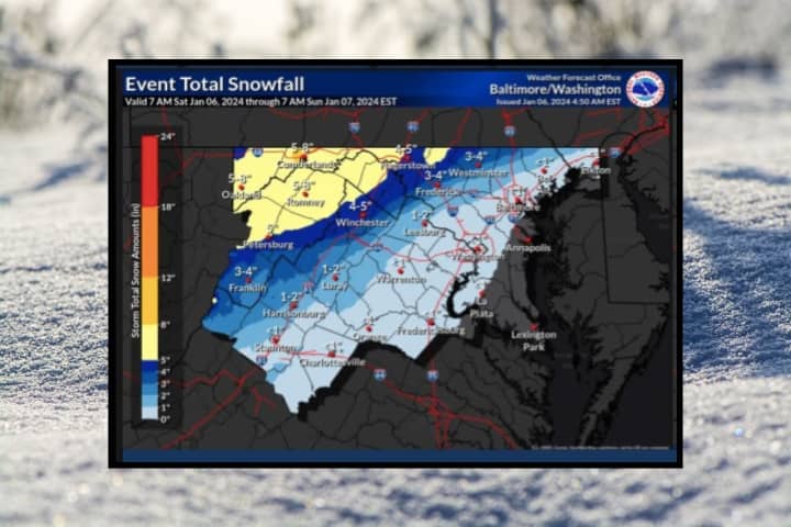
But according to the National Weather Service, the worst is yet to come.
A winter storm warning remains in effect until 7 p.m. from the Baltimore/Washington DC National Weather Service, who warned of slippery and dangerous road conditions through the evening.
Sleet and freezing rain were arrived in northern Virginia and Maryland Saturday morning, Jan. 6, and was expected to remain light until the afternoon and evening, the NWS said.
In northern Maryland, between 2 and 4 inches of snow accumulation was expected by the evening. In the Baltimore and Washington DC area, dense fog and heavy rain are on the horizon, with only an inch of snow accumulation likely.
Northern Virginia, meanwhile, might only see heavy rain with less than an inch of accumulation being forecast by the NWS. There is also a chance, though, of a wintry mix of rain and snow, with two inches of accumulation possible.
Any snow will turn to rain overnight, with a chance of freezing rain to continue into Sunday morning, Jan. 7, the NWS said.
Sunday, Jan. 7 will be mostly sunny with a high near 50 in northern VA. Temps will stay closer to 40 with partly cloudy skies in the Baltimore/DC area.
Want breaking news in the DMV as it happens, or want to contribute? Join the DMV All Incidents Facebook group.
Click here to follow Daily Voice Montgomery and receive free news updates.


