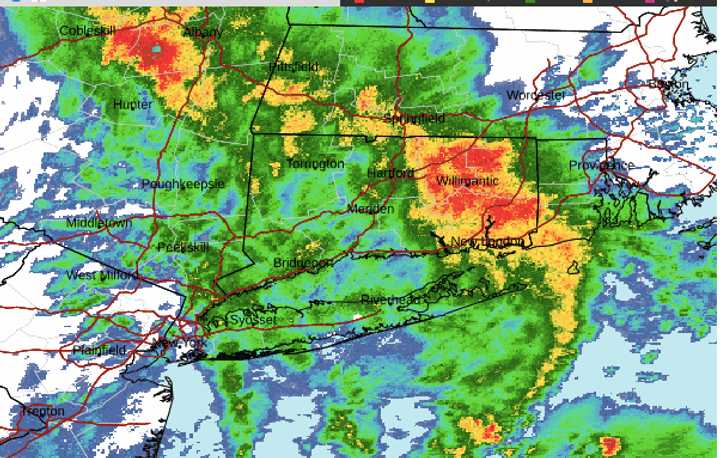
A radar image of the region from just before 8:30 a.m. Thursday, Nov. 21 above shows areas (in orange) with storms.
It's the first soaking rain for much of the Northeast since late September.
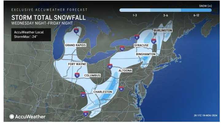
The second image above shows the broad area where snowfall is expected on the back end of the system from Thursday night into Friday, Nov. 22.
A total of 6 to 12 inches is predicted in those spots shown in the darkest shade of blue, mainly areas in the higher elevations of New York, Pennsylvania, Maryland and West Virginia, according to AccuWeather.
It will be a raw and blustery day with a high temperature of around 50 degrees Thursday, wind speeds of 15 miles per hour, and gusts as high as 30 mph.
New precipitation totals of an inch or 2 inches of rain are expected on Thursday, with a widespread total rainfall amount of around 3 inches for the entire duration of the storm.
Strong wind gusts of 25 mph will continue Thursday night, and those areas where snowfall is expected will see it on the back end of the system at that time.
Friday will be mostly cloudy and colder, with a high temperature in the low 40s. There could be lingering showers during the day and again at night.
It will remain brisk on Saturday, Nov. 23, with a high temperature in the upper 60s and partly sunny skies.
It will become mostly sunny on Sunday, Nov. 24, with a high temperature of around 50 degrees.
Check back to Daily Voice for updates.
Click here to follow Daily Voice Wrentham and receive free news updates.

