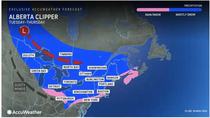
Tuesday, Dec. 3, will mark the start of a string of days in which Alberta Clipper systems with fast-falling snowfall are possible in these areas shown in pink and blue in the image above from AccuWeather.
According to current forecast models, the highest likelihood for snowfall in the Northeast is overnight Wednesday, Dec. 4 into Thursday, Dec. 5, according to the National Weather Service.
Areas farther south will likely see mainly snow showers but accumulating snow is possible farthest inland.
"It is pretty rare for much snow to accumulate with a storm track of this nature from southern New England to the mid-Atlantic in the coastal Northeast, but areas farther to the north (and west) stand a better chance at picking up some accumulating snow," said AccuWeather Senior Long-Range Meteorologist Joe Lundberg.
Current long-range forecasts show a chance for sleet and freezing rain on both Monday, Dec. 9, and Tuesday, Dec. 10, and then again, Thursday, Dec. 12.
There is the also potential for a more significant system on Friday, Dec. 13 that could bring accumulating snowfall.
Check back to Daily Voice for updates.
Click here to follow Daily Voice Sturbridge-Brookfield and receive free news updates.

