According to the National Weather Service, wind chill values will be below freezing most of the time on Friday, Dec. 6, and Saturday, Dec. 7. Both days will have a mix of sun and clouds.
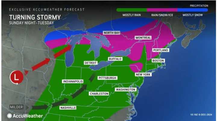
Then, an overnight Alberta Clipper system with a mix of sleet and snow that will sweep through the northernmost parts of the Northeast Saturday into Sunday, Dec. 8, will usher in a change for the entire East Coast starting in the second half of the weekend.
"After a January-like cold start to the weekend in the East, temperatures will gradually climb into the first part of next week," according to AccuWeather.com.
On Sunday, temperatures will climb into the mid-40s, with the mercury climbing over 50 degrees farther south. It will be partly to mostly sunny.
An unsettled, stormy stretch will then start on Monday, Dec. 9, with rain arriving in the afternoon and continuing into the evening, especially farther north.
Tuesday, Dec. 10, will be mostly cloudy, with more unseasonably mild temperatures and more showers, with rain possible starting in the afternoon.
Check back to Daily Voice for updates.
Click here to follow Daily Voice Orange-Athol and receive free news updates.

