"Later this week into the upcoming weekend, forecasters are monitoring the potential for a storm to take shape along the Southeast Coast," said AccuWeather.com, noting that it could pose a threat "for rounds of rain along the mid-Atlantic and New England coasts by the upcoming weekend."
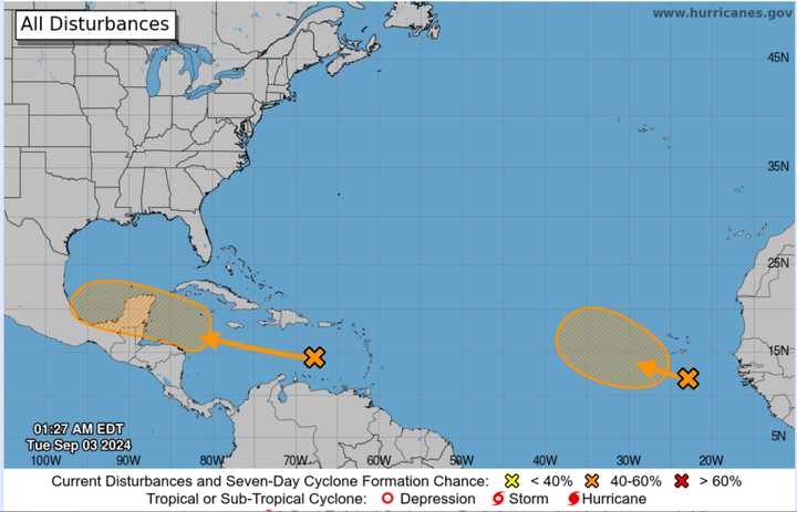
Forecasters are now monitoring these other systems over multiple zones.
Here's a rundown:
A westward-moving tropical wave in the Caribbean Sea is "expected to become more conducive for development when the system reaches the western Caribbean Sea and the southwestern Gulf of Mexico late this week, and over the weekend," says the National Hurricane Center, "and a tropical depression could form during that time."
In the Eastern Tropical Atlantic, another tropical wave, now located near the Cape Verde Islands in West Africa, could become a tropical depression in a few days as it moves slowly west-northwestward or northwestward over the eastern tropical Atlantic Ocean.
The next storm name for the Atlantic basin will be called Francine.
The 2024 Atlantic hurricane season began on Saturday, June 1, and runs through Saturday, Nov. 30.
Check back to Daily Voice for updates.
Click here to follow Daily Voice Milton and receive free news updates.
