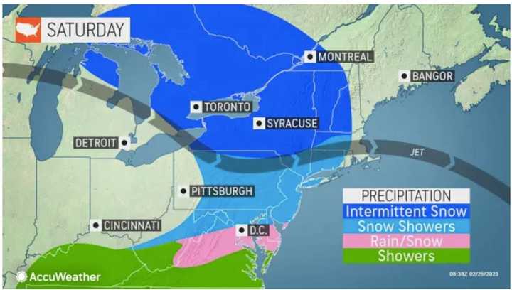
Wind gusts will be as high as 30 miles per hour Saturday morning, Feb. 25 on a day in which the high temperature will be right around the freezing mark, but with wind-chill values in the teens, the National Weather Service says.
There will be a band of light snow moving through from the late morning until the mid to late afternoon on Saturday. (See the first image above from AccuWeather.com.) Other areas could see a coating to an inch as well as slippery driving conditions at times.
Areas mainly north of the I-84 corridor could see an inch or two of accumulation.
Sunday, Feb. 26 will be partly sunny with a high temperature in the mid 40s with wind-chill values in the 20s in the morning, according to the National Weather Service.
After a partly sunny start to the day, the potentially more significant system is currently on track to arrive late Monday afternoon, Feb. 27 or early Monday evening.
Snow could continue at times until around midday Tuesday, Feb. 28 before the high temperature climbs into the upper 30s.
Areas in northern New York and northern New England could see 6 inches to a foot of snow accumulation. (Click on the second image above from AccuWeather.com.)
But there's still some uncertainty surrounding the storm's timing, track, and potential strength.
Check back to Daily Voice for updates.
Click here to follow Daily Voice Lynn and receive free news updates.

