Some areas in the Northeast could see up to a foot of snow.
The storm's time frame is overnight Sunday, Jan. 5, through Monday evening, Jan. 6. The heaviest snowfall is expected in southernmost areas, including Maryland and Virginia, according to the National Weather Service.
Central and Southern New Jersey/Southern Pennsylvania: 3 to 6 inches of snow.
Northern New Jersey, New York City, Long Island, Lower Hudson Valley, and Coastal Connecticut: A trace to 2 inches of accumulation, mainly before early afternoon Monday. It's possible if the storm tracks farther south, there may be no precipitation at all.
Meteorologists are emphasizing the dual threats of snow and ice accumulation, which could cause significant disruptions
“Some places will have snow and ice then switch back to snow," said AccuWeather Senior Director of Forecasting Operations Dan DePodwin. "That’s a bad combination. Heavy snow and ice accretion can bring down tree limbs and power lines."
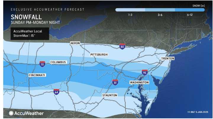
The latest snowfall projections are shown in the first image above from AccuWeather:
- Darkest Shade of Blue: 6 to 12 inches.
- Next Shade of Blue: 3 to 6 inches.
- Lightest Shade of Blue: 1 to 3 inches.
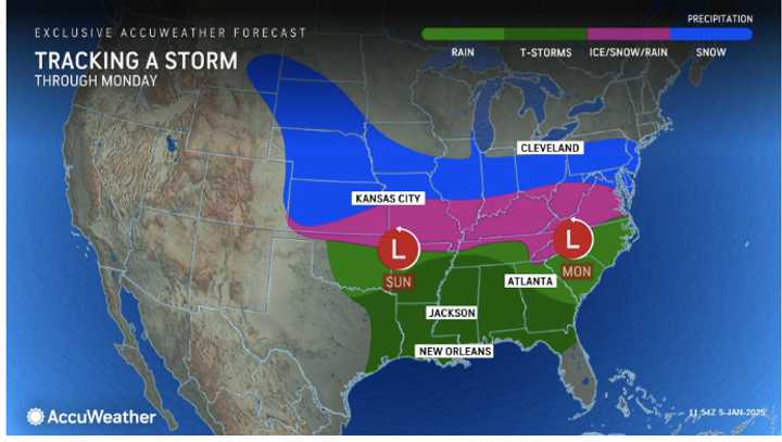
For precipitation types by region, click on the second image above from AccuWeather.
"It will be very cold after this storm," DePodwin added. "This could lead to slower clean-up from the storm."
Check back with Daily Voice for updates.
Click here to follow Daily Voice Ludlow and receive free news updates.

