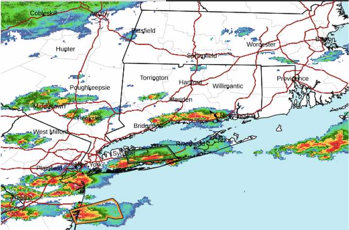
A radar image of the region above, from just before 3:30 p.m. Tuesday, Aug. 6, shows severe storms marked in red.
"Excessive runoff may result in flooding of rivers, creeks, streams, and other low-lying and flood-prone locations," the National Weather Service issued a Hazardous Weather Outlook statement issued Tuesday.
The statement added, "Creeks and streams may rise out of their banks. Flooding may occur in poor drainage and urban areas. Extensive street flooding and flooding of creeks and rivers are possible."
About 2 inches of rainfall is generally expected through around midday on Wednesday, Aug. 7, with locally higher amounts.
After the system passes through, and starting Wednesday, the high temperature will be in the low to mid-70s each day through the end of the week.
Some sun will return on Thursday, Aug. 8, but more showers and storms are possible in the afternoon and evening.
The remnants of Debby are expected to affect the Northeast on Friday, Aug. 9, and Saturday, Aug. 10, with a widespread 2 to 4 inches of rainfall expected during that time.
Check back to Daily Voice for updates.
Click here to follow Daily Voice Hamilton-Wenham and receive free news updates.
