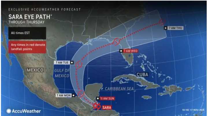
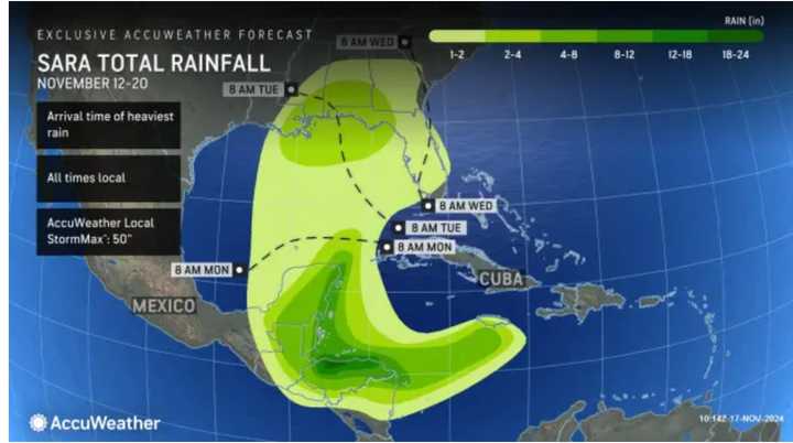
First, heavy rainfall will cause potential catastrophic flash flooding and mudslides as it moves across northern Honduras and Belize on Sunday, Nov. 17, according to the National Hurricane Center.
After reaching the Yucatán Peninsula, Sara is expected to approach the Gulf of Mexico, then move toward Florida, and move tropical moisture into the state by Wednesday, Nov. 20.
"The exact track when over the Gulf will depend on Sara's organization and ability to regain strength at midweek," according to AccuWeather. "A storm with lower sustained winds is more likely to be pulled into the front and to the north--perhaps over the central Gulf coast. A more organized tropical depression or storm is more likely to track more to the east and into the Florida Peninsula."
For the latest projected track and timing for Sara, check the first image above.
For projected rainfall amounts from the storm, click on the second image above.
Starting on Wednesday, tropical moisture from Sara is expected to merge with a cold front accompanying a multi-threat storm moving to the East Coast from the Midwest.
Rain could mix with snow in some spots in the Northeast, especially northern New England.
The exact timing of both systems is uncertain, and more forecast models will develop in the coming days.
The 2024 Atlantic hurricane season runs through Saturday, Nov. 30.
Check back to Daily Voice for updates.
Click here to follow Daily Voice Gardner and receive free news updates.

