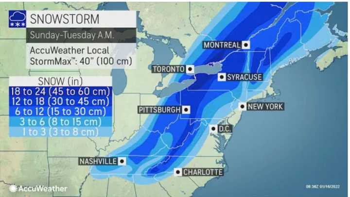
The time frame for the storm is after nightfall Sunday, Jan. 16 into Monday afternoon, Jan. 17 on Martin Luther King Jr. Day.
A Winter Weather Advisory is in effect for Central and Western Massachusetts from midnight to 7 a.m. Monday.
After a frigid start with single-digit temperatures in the morning, Sunday's high will rebound in the afternoon and reach the low 30s, but strong winds will make it feel much cold, and clouds will thicken during the day.
The storm system is expected to arrive from south to north after sunset on Sunday evening, with a mix of heavy rain, sleet, and snow, and continue into Monday afternoon.
Snow will change to rain in coastal areas where the temperature will rise above the freezing mark Sunday evening.
Generally, total snow accumulations of 1 to 4 inches is expected in Central and Western Massachusetts, according to the National Weather Service. A light glaze of icing is also possible. (Click on the first image above to see projections by AccuWeather.)
"The storm will move swiftly northeastward with the heaviest snow lasting only about six hours and most of the snowfall spanning about 12 hours," said AccuWeather Senior Meteorologist Bill Deger, who noted that "the intense rate of snowfall will make up for its short duration."
The storm will be accompanied by dangerous wind gusts as high as 30 miles per hour in Massachusetts.
Check back to Daily Voice for updates.
Click here to follow Daily Voice Amherst and receive free news updates.

