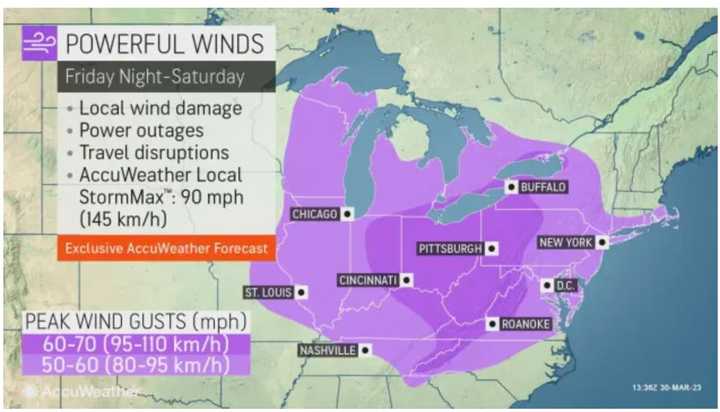
The system arrived in the pre-dawn hours on Saturday, April 1 with rain and showers.
Storm activity is expected to pick up in the afternoon through the evening. For a look at the wide area where severe storms are possible, see the first image above from AccuWeather.com.
"The primary threat is from damaging wind gusts, but hail and an isolated, brief tornado are also possible," the National Weather Service said in a Hazardous Weather Statement issued early Saturday morning.
Wind gusts during the height of the storm will be as high as 50 to 60 miles per hour. (See the second image above from AccuWeather.com.)
The temperature will rise to a high in the mid to upper 60s on Saturday as the storm system pushes through.
Around a half-inch of rainfall is expected from the storm.
Skies will gradually clear overnight into Sunday, April 2, which will be sunny and breezy with a high temperature of around 50 degrees.
The outlook for Monday, April 3 calls for mostly sunny skies with a high in the upper 50s.
Check back to Daily Voice for updates.
Click here to follow Daily Voice Windham-Willimantic and receive free news updates.

