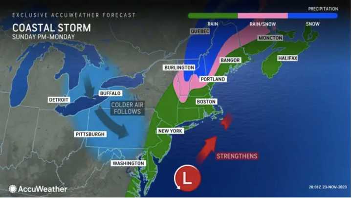
The time frame for the system is late Sunday afternoon, Nov. 26 into the early morning hours of Monday, Nov. 27, according to the National Weather Service.
"On Sunday, rain will mainly be confined to eastern Virginia, Maryland, and Delaware before spreading into New Jersey, Pennsylvania, and New York by Sunday night," according to AccuWeather.com. "By Monday, rain will primarily focus across New England."
As the system collides with cold air, areas in upstate New York, northwestern Massachusetts, and northern New England (shown in pink in the image above) will see some snowfall overnight, especially in areas with higher terrain.
Ahead of the arrival of the system, Small Business Saturday, Nov. 25 will be mostly sunny and cold with a high temperature of around 40 degrees. Wind speeds will be weaker than they were a day earlier.
Sunday will be partly sunny most of the day with the high temperature in the mid to upper 40s.
There will be a chance for rain starting in the late afternoon as the quick-moving system moves in, bringing about three-quarters of an inch of rain to most spots in the region.
Rain will wind down from west to east starting just after daybreak on Monday before finally tapering off in eastern New England later in the morning.
Skies will then gradually become partly sunny on Monday, and the high temperature will rise to around 50 degrees.
Tuesday, Nov. 28 will be mostly sunny, brisk, and breezy with a high temperature in the mid-30s.
Check back to Daily Voice for updates.
Click here to follow Daily Voice Windham-Willimantic and receive free news updates.
