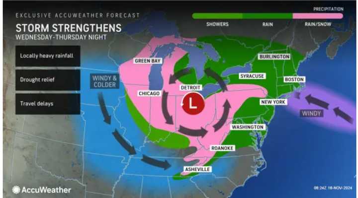
The system is expected to arrive overnight Wednesday, Nov. 20, bringing rain at times throughout the day Thursday, Nov. 21, that will linger into Friday, Nov. 22, according to the National Weather Service.
The storm will bring a mix of snow and rain in areas shown in pink and rain in spots shown in green in the image above from AccuWeather.
"The more obvious conditions from the storm, depending on its intensity, will be a period of strong winds centered on the Great Lakes but expanding through much of the Midwest and into the East," said AccuWeather Senior Meteorologist Brett Anderson.
After a cloudy start with sprinkles in spots, Monday, Nov. 18, it will quickly become mostly sunny. The high temperature will be in the low 60s.
Temperatures will become more seasonable on Tuesday, Nov. 19, with sunny skies and a high in the mid-50s.
Ahead of the system's arrival, Wednesday will be partly sunny, with temperatures topping out in the upper 50s.
Rainfall will arrive from west to east Wednesday night, with up to around three-quarters of an inch possible into Thursday morning.
Thursday will be rainy and raw, with a high temperature of around 50 degrees.
Rain will continue overnight into Friday, with scattered showers expected during the day, especially in the morning. It will be a brisk day, with a high temperature in the mid-40s.
Skies will become partly sunny during the afternoon, but a stray shower can't be ruled out in the afternoon and evening.
Check back to Daily Voice for updates.
Click here to follow Daily Voice West Haven and receive free news updates.
