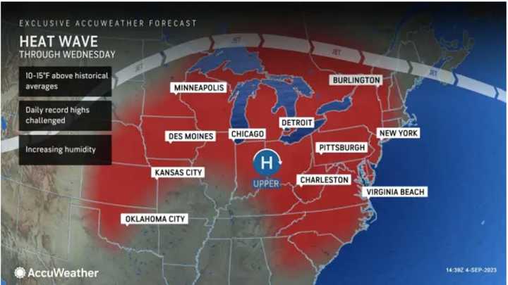
According to AccuWeather Senior Meteorologist Heather Zehr: "Temperatures early this week are topping out 10-15 degrees above normal from interior New England down through the mid-Atlantic, while coastal areas in New England will be closer to the historical average. Even those areas will warm up heading toward the middle of the week."
The high temperature on Tuesday, Sept. 5, and Wednesday, Sept. 6 will range from the upper 80s to low 90s both days with the heat index in the mid to upper 90s due to high humidity, according to the National Weather Service.
There will be a mix of sun and clouds on both days.
It will remain hot Thursday, Sept. 7 with mainly sunny skies and a high temperature generally in the low 90s.
Clouds will increase Thursday night as unsettled conditions arrive, prompting the separate storm chances.
The first chance for showers and thunderstorms will be in the overnight hours leading into Friday morning, Sept. 8.
It will be cloudy throughout the day Friday, and not as warm, with a high temperature in the mid-80s before the next chance for showers and thunderstorms from the middle of the afternoon into Friday evening.
Saturday, Sept. 9 will be cloudy with a high temperature in the low 80s before a new round of storms and showers is likely from the middle of the afternoon into the middle of the evening.
It will remain cloudy on Sunday, Sept. 10 with a high temperature of around 80 degrees. There could be scattered showers in the afternoon and evening.
Check back to Daily Voice for updates.
Click here to follow Daily Voice Torrington and receive free news updates.
