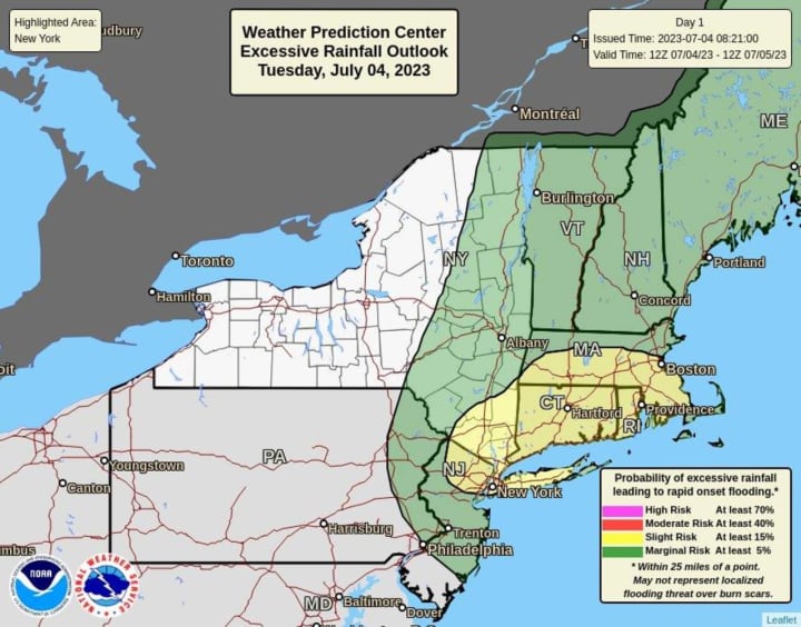
That's because a new round of thunderstorms -- with heavy downpours, frequent lightning, thunder, and strong winds -- is likely in much of the region on Tuesday, July 4.
There will be clouds with some breaks of sunshine in the morning followed by scattered showers and thunderstorms in the afternoon and evening.
Areas shown in yellow in the image above from the National Weather Service are most likely to see July 4th storms, some of which will be severe.
In eastern New England, some storms could produce gusty winds, heavy rain, and frequent lightning.
"Storms will be slow-moving and capable of producing heavy rainfall," the National Weather Service said in a statement issued Tuesday morning. "Areas of minor flooding can be expected. There is also a localized flash flood risk where persistent storms set up."
Up to an inch or so of rainfall is possible Tuesday, with locally higher amounts.
Tuesday's high temperature will generally be in the low-80s.
It will be warm both Wednesday, July 5, and Thursday, July 6 with mostly sunny skies both days and a high temperature generally in the upper 80s.
Friday, July 7 will be mostly sunny with a high temperature in the mid-80s. There's a slight chance of scattered showers in the afternoon and evening.
Check back to Daily Voice for updates.
Click here to follow Daily Voice Windham and receive free news updates.


