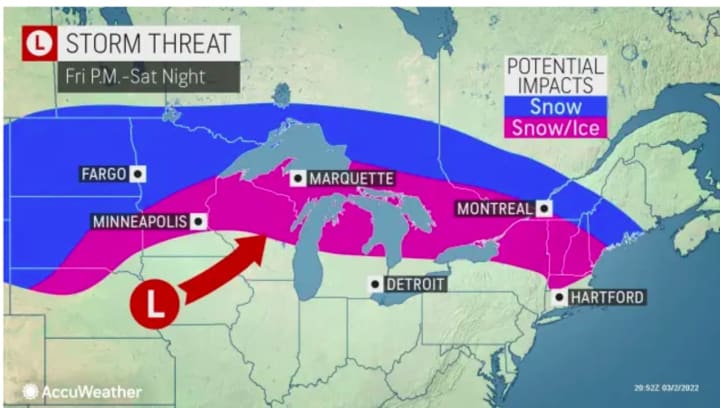
The projected track has changed for a new winter storm taking aim on the Northeast that is expected to bring a mix of snow, sleet, and rain.
The time frame for the storm system's impact in this area is Saturday night, March 5 into Sunday morning, March 6.
It is now expected to veer farther north and east. (See the image above.)
"In the Northeast, the majority of ice or a wintry mix will generally be confined to upstate New York and central and northern New England with rain forecast for Pittsburgh, New York City, Hartford, Connecticut, and Boston on south from Saturday afternoon to Saturday night and early Sunday," said AccuWeather Senior Meteorologist Bill Deger.
Thursday, March 3 will be partly cloudy with a high temperature in the upper 30s before falling in the afternoon to the low 30s, according to the National Weather Service. The overnight low will be in the mid to upper teens with wind-chill values of around 10 degrees.
Friday, March 4 will be sunny with a high temperature in the mid 30s and wind-chill values between 15 and 25 degrees.
It will be mostly cloudy during the day on Saturday prior to the storm system's arrival. The high temperature will be in the mid 40s before dipping to around 30 degrees overnight into Sunday.
In areas where there is a wintry mix and snow, precipitation will change to rain quickly after daybreak Sunday as the high temperature is expected to climb to around 60 degrees with cloudy skies throughout the day.
Check back to Daily Voice for updates.
Click here to follow Daily Voice Wilton and receive free news updates.


