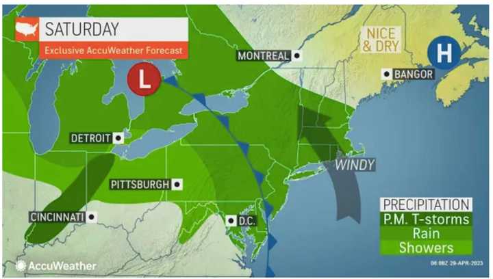
According to the National Weather Service, the heaviest rain from the first round of storms should wrap up by around midday Saturday, April 29 after dumping about an inch of precipitation to most of the region.
Rain will be lighter in the afternoon with some breaks in the precipitation. It will be raw throughout the day with a high temperature of around 50 degrees.
Sunday morning, April 30 will start off dry before the next storm system arrives in the early afternoon. (Click on the second image above.)
It's expected to have more substantial rain and wind than the first storm, according to AccuWeather.com.
The heaviest rain will be from late Sunday afternoon into Sunday evening.
Since temperatures will be milder, with highs in the upper 50s, isolated thunderstorms could be sparked.
"The strongest winds will be on the front side of the second storm with a six- to 12-hour period where easterly gusts to 60 mph are possible along the coast from Delaware and New Jersey to Maine," according to AccuWeather Senior Meteorologist Brett Anderson.
Rain could be heavy at times into around daybreak Monday, May 1.
Skies will then gradually become mostly sunny during the day Monday and the high temperature will be in the low 60s.
Widespread new rainfall amounts of an inch-and-a-half of precipitation are expected, with some parts of the region seeing as much as 3 inches of rain total from the two storm systems.
Check back to Daily Voice for updates.
Click here to follow Daily Voice Westport and receive free news updates.

