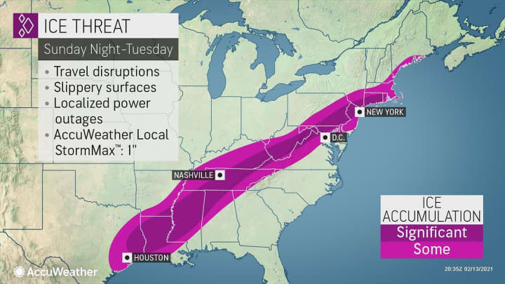


The first blast came overnight into Valentine's Day on Sunday, Feb. 14 with an icy mix causing travel slick roads and walkways through the morning with scattered power outages.
"This light precipitation can be every bit as dangerous to drive and walk on as a major storm, and motorists and pedestrians should be on the lookout," AccuWeather Lead Storm Warning Meteorologist Joe Bauer said.
Sunday, Feb. 14 will be cloudy with temperature in the low 30s and wind-chill values in the 20s.
A new round of rain, freezing rain, and sleet is expected after midnight into Presidents Day morning on Monday, Feb. 15. It will be another cloudy day with a high temperature around the freezing mark and wind-chill values in the low 20s.
Then another new round of freezing rain will become likely after nightfall Monday and continue at times through the day on Tuesday, Feb. 16, with the potential 1-3 inches of snowfall accumulation for areas north of I-84 in New York, Connecticut, and Massachusetts.
There will then be a bit of break from the wintry precipitation Tuesday night into Wednesday, Feb. 17, which will be mostly sunny and cold, with a high temperature around 30 degrees.
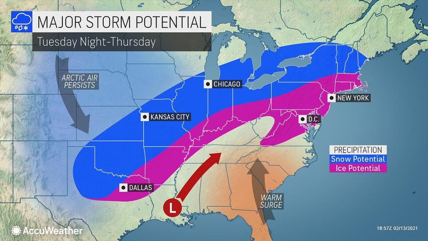
Clouds will thicken overnight Wednesday ahead of the next possible storm system on track to arrive sometime around midday Thursday, Feb. 18, moving from the midwest to the East Coast. (See the first image above.)
The chance for snow and sleet continues through the evening and will continue into early Friday morning, Feb. 19.
It's too early to project possible snowfall totals due to uncertainty surrounding the track, duration, and strength of the system.
Check back to Daily Voice for updates.
Click here to follow Daily Voice Westport and receive free news updates.