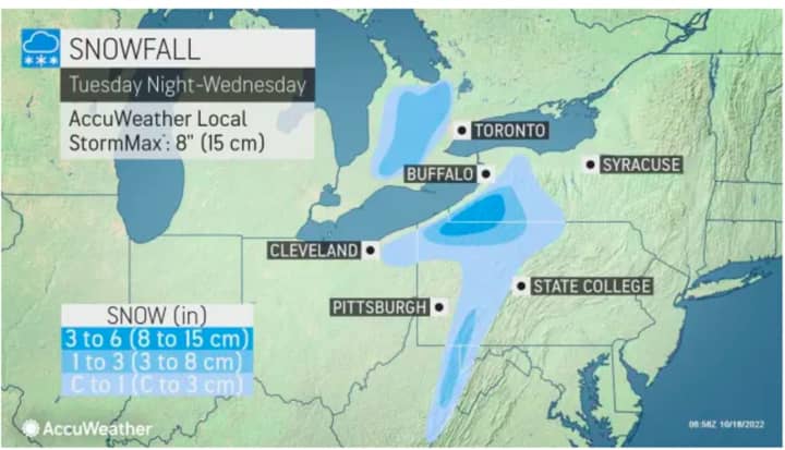
Areas in the darker shade of blue in the image above from AccuWeather.com could see 3 to 6 inches of accumulation Tuesday night, Oct. 18 into Wednesday, Oct. 19.
"The upcoming accumulating snow and snowflakes over the interior Northeast is a little sooner than average and more typical for the region during the tail end of October, rather than the middle part of the month," according to AccuWeather Senior Storm Warning Meteorologist Brian Wimer.
The possibility of 1 to 3 inches of snowfall is possible over a broader area, encompassing the westernmost parts of New York, Pennsylvania, and Maryland, where the accumulations are expected on non-paved surfaces.. (Shown in the lighter shade of blue.)
"Outside of the higher elevations, temperatures may not even dip below freezing," said Wilmer. "But, over the higher terrain in these areas, a general coating to a few inches of snow with locally higher amounts is possible, from Tuesday night to Wednesday morning."
Cold air and winds from the system will reach the Atlantic Coast in the Northeast Tuesday night into Wednesday, according to AccuWeather. (Click on the second image above.)
Click here to read the complete AccuWeather.com report.
Click here to follow Daily Voice Westport and receive free news updates.


