- Click here for an updated story: Projected Snowfall Totals Increase For Super Bowl Sunday Nor'easter
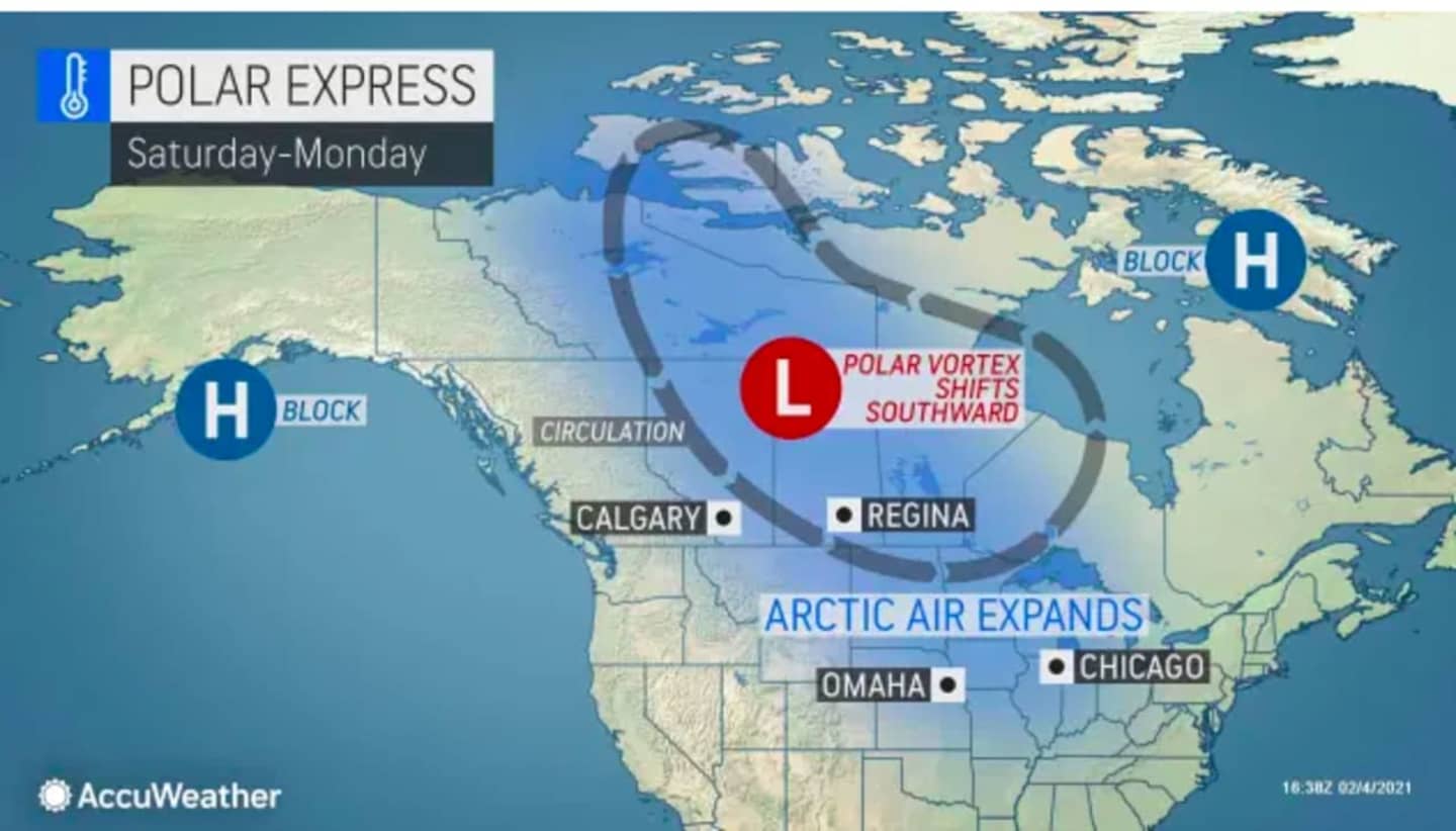
As an Arctic blast of frigid arrives with a southward shift in the Polar Vortez, there will be several chances for snowfall into early next week.
The active weather pattern started early Friday morning, Feb. 5 with the arrival of a wintry mix and light snow to parts of the region farther north and inland.
Precipitation will change to rain later in the morning before the system pushes off the coast before midday on a mostly cloudy day with a high temperature in the upper 30s.
Saturday, Feb. 6 will be sunny with a high temperature in the mid 30s. But strong winds with gusts up to 25 miles per hour will make it feel like it's between 15 and 25 degrees.
Clouds will increase overnight with the temperature dropping to the low 20s
Low pressure will move off the coast, and may come close enough to the area to bring an accumulating snowfall on Super Bowl Sunday, Feb. 7, the National Weather Service said in a Hazardous Weather Outlook statement issued early Friday morning.
Current projections call for between 1 to 3 inches of snowfall Sunday morning into early Sunday evening. The current time frame for snow is from just before daybreak to around 8 p.m. Sunday.
After a sunny and frigid day on Monday, Feb. 8, with a high temperature of around 30 degrees, the next chance for snow will come during the day on Tuesday, Feb. 9. Currently, a coating to an inch of snow is possible Tuesday morning into around midday.
Check back to Daily Voice for updates.
Click here to follow Daily Voice Trumbull-Monroe and receive free news updates.