Ahead of the midweek arrival of the system, an overnight wintry mix farther north will become all rain later in the morning Tuesday, Feb. 21 on a mostly cloudy day in which the high temperature rises to the mid 40s to low 50s.
The storm is expected to arrive from west to east in the afternoon on Wednesday, Feb. 22 with some areas seeing sleet mixed in.
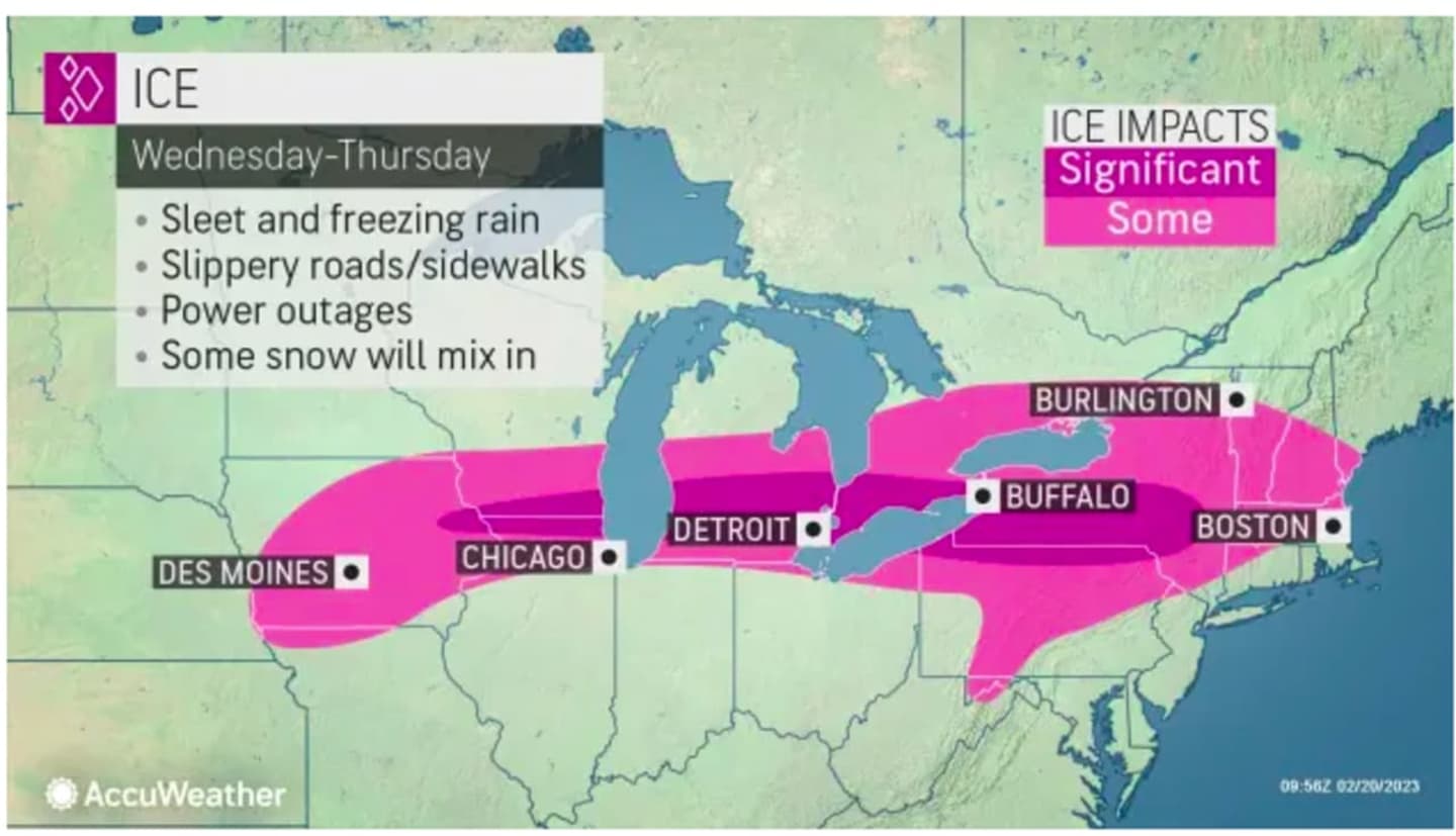
As the temperature falls Wednesday night, areas farthest north and inland, mainly above the I-84 corridor, will see sleet at times. (See the image above from AccuWeather.com.)
It will remain unsettled on Thursday, Feb. 23, with rain continuing through the morning on another cloudy day. It will be mainly dry during the afternoon before a new round of precipitation is possible Thursday night.
Skies will gradually clear overnight, leading to a mostly sunny day on Friday, Feb. 24. It will be blustery during the day and into the evening.
Check back to Daily Voice for updates.
Click here to follow Daily Voice Trumbull-Monroe and receive free news updates.