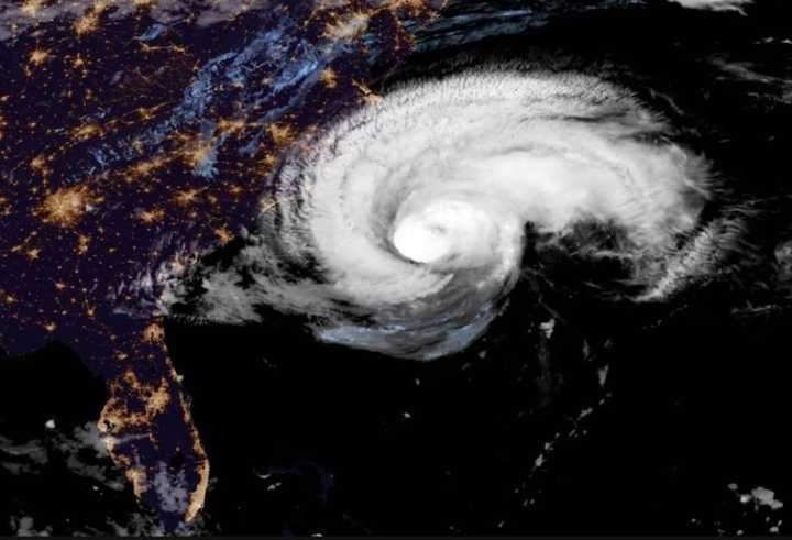
With Hurricane Florence's outer bands now nearing the Carolina Coast, millions of people in several states are now bracing for a days-long stretch of massive amounts of rain, devastating flooding and 100-plus mile-per-hour winds that could knock out power to some for weeks.
While the storm's winds have weakened since Wednesday, making it now a Category 2 storm, its range has grown and its damaging effects are now expected to be felt far inland and in several states beyond North Carolina and South Carolina, which will be hit hardest. (See second image above.)
Some areas in the Myrtle Beach/Wilmington area could see as much as 40 inches of rain with storm surges between 9 and 13 feet, overwhelming many beachfront areas and low-lying islands.
As many as three million people are expected to lose power.
Florence was centered about 205 miles east-southeast of Wilmington at around dawn on Thursday. It's moving toward the northwest near 15 mph. Maximum sustained winds are near 110 mph with higher gusts.
On the forecast track, the center of Florence will approach the coasts of North and South Carolina later in the day Thursday, then move near or over the coast of southern North Carolina and eastern South Carolina Thursday night and Friday. A slow motion over eastern South Carolina is forecast Friday night through Saturday night.
After making landfall in the lower Outer Banks of North Carolina, the storm is expected to make a shift to the left toward South Carolina before trekking west. (See second image above.) Earlier this week, it had been projected to shift north after making landfall.
More than 1.5 million people have been ordered to evacuate along 300 miles of coastline.
This continues to be a developing story. Check back to Daily Voice for updates.
Click here to follow Daily Voice Trumbull-Monroe and receive free news updates.

