Tuesday, June 22 will be cloudy and a high temperature in the mid 70s.
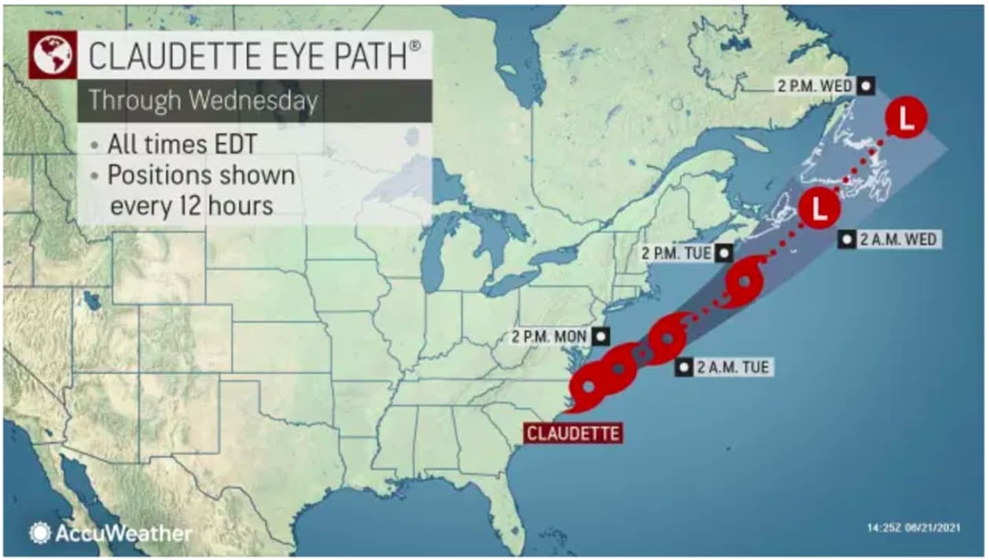
Showers, steady rain, and scattered storms will arrive during the late morning and continue throughout the afternoon Tuesday as Tropical Storm Claudette moves up the Northeast well off the coast. New rainfall amounts of a half-inch are possible.
The temperature will fall into the low 60s by late afternoon as a cold front pushes through.
Showers and storms will wind down around nightfall Tuesday, followed by clearing skies.
Skies will gradually clear later on Tuesday night and through the overnight hours as Claudette moves away from the East Coast.
Wednesday, June 23 will be sunny and pleasant, with a high temperature in the mid 70s.
Thursday, June 24 will be another picture-perfect day, with plenty of sunshine and temperatures in the mid to upper 70s.
Check back to Daily Voice for updates.
Click here to follow Daily Voice Stratford and receive free news updates.