
Bright sunshine will begin to fade behind increasing clouds on Saturday afternoon, Nov. 23 with the high temperature in the mid 40s.
Rain will arrive late Saturday night. There will be a mix of snow and rain farther north and inland (mainly north of I-84 in New York and Connecticut) as the overnight low temperature will be right around the freezing mark. A trace to an inch of snowfall accumulation is possible in those areas, with 0.1 of ice accumulation also possible.
Sunday, Nov. 24 will be a mostly cloudy, raw and rainy day in which the high temperature will climb to the low to mid 40s. Rain will finally taper off sometime after 3 p.m.
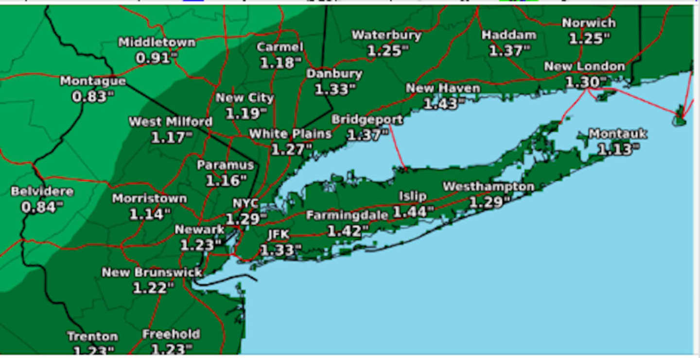
About an inch to an inch and a quarter of rainfall is expected, with highest amount farthest south, especially on Long Island, where some areas could see nearly 1.5 inches. (See second image above.)
Monday, Nov. 25 will be mostly sunny, with a high temperature in the mid to upper 40s.
Check back to Daily Voice for updates.
Click here to follow Daily Voice Stamford and receive free news updates.