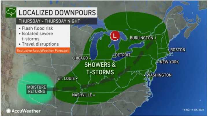
The time frame for the first system is Thursday night, July 13 into Friday, July 14 with the approach of a frontal system, according to the National Weather Service.
Rainfall of about 1 inch with locally higher amounts of around 2 inches is possible.
"The strongest thunderstorms during this time may also be capable of producing damaging wind gusts," according to the weather service.
The stormy pattern is expected to linger through Tuesday, July 18.
"While a setup exactly like the one that resulted in 5–10 inches of rain and locally higher amounts from parts of Pennsylvania to eastern New York and Vermont is not likely," according to AccuWeather.com, "multiple smaller-scale events may occur with overlapping rainfall over an approximate six-day period from Thursday to next Tuesday in the Northeast."
Ahead of the arrival of the first system, Wednesday, July 12 will be mostly sunny and more humid with a high temperature of around 90 degrees.
Thursday will be partly sunny, hot, and humid with a high temperature again around 90 degrees.
The first round of storms is expected overnight, continuing into Friday. Some of the storms could be heavy at times.
It will be mostly cloudy throughout the day Friday, with a high temperature in the low 80s.
Check back to Daily Voice for updates.
Click here to follow Daily Voice Shelton and receive free news updates.
