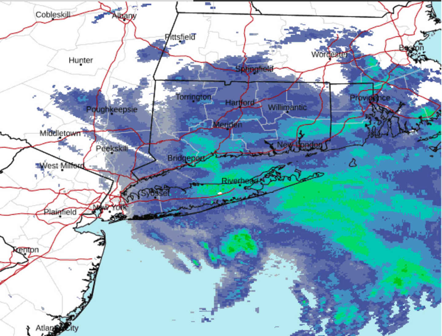
Snowfall will continue at times during the morning on Tuesday, Feb. 28 after arriving Monday evening, Feb. 27. The timing of the system had led to the closures of hundreds of school districts in New York and Connecticut.
Some areas farther north and inland, including in parts of the Hudson Valley and northern Connecticut, have already seen half a foot of snow as of around 7:30 a.m. Tuesday.
Tuesday's high temperature will be in the mid-30s with wind-chill values in the teens and 20s, according to the National Weather Service.
It will be mostly cloudy throughout the day and evening Tuesday before skies gradually clear overnight, leading to a mostly sunny day on Wednesday, March 1.
Wednesday's high temperature will be in the low to mid-40s, with wind-chill values in the 20s.
The high temperature on Thursday, March 2 will climb to around 50 degrees with showers possible as an unsettled weather pattern starts that will last into the start of the weekend.
Check back to Daily Voice for updates.
Click here to follow Daily Voice Norwalk and receive free news updates.