

After a one-day reprieve from the barrage of wintry weather on Wednesday, Feb. 17, the storm is now expected to arrive late Thursday morning, Feb. 18, and continue into around noontime on Friday, Feb. 19, with the potential for moderate to heavy snowfall and a brief wintry mix, the National Weather Service said.
Just about the entire area now could see as much as 6 or more inches of snowfall, though there is still uncertainty in the location of the greatest amounts and the extent of mixing in parts of the region, the National Weather Service said in a statement issued Wednesday morning.
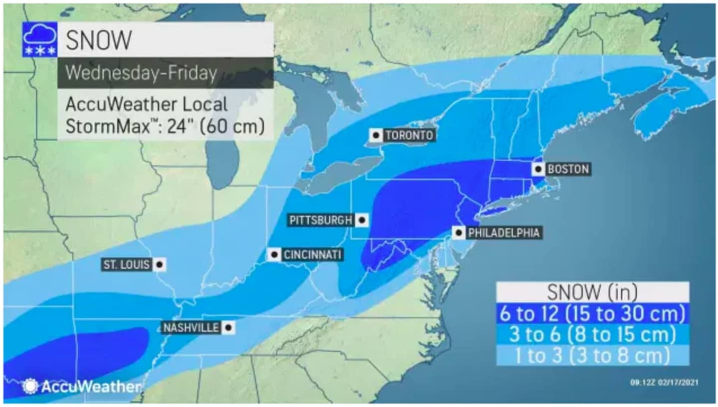
For the latest snowfall projections from AccuWeather, see the first image above.
For brand-new snowfall projections from the National Weather Service, click on the second image above.
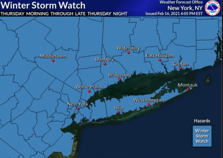
A Winter Storm Watch, in effect for the entire region, has been extended until 4 p.m. Friday. It takes effect at 6 a.m. Thursday. (See the third image above.)
"Travel could be very difficult," the National Weather Service said. "The hazardous conditions could impact the morning or evening commute."
The heaviest snow in the Northeast is expected from northern and central Pennsylvania through upstate New York and central and northern New England.
Wednesday will be sunny and cold Wednesday with a high temperature in the low to mid 30s, and wind-chill values between 10 and 20 degrees.
Clouds will thicken overnight Wednesday ahead of the storm system.
There is still some uncertainty surrounding the track of the system, which could increase or decrease the final projected snowfall totals ahead of the storm.
Check back to Daily Voice for updates.
Click here to follow Daily Voice Norwalk and receive free news updates.