The arrival of a cold front on Monday, Oct. 17 will bring some showers or thunderstorms at times on a mostly cloudy day with a high temperature in the mid-50s, according to the National Weather Service.
Overnight Monday into Tuesday morning Tuesday, Oct. 18 is the time frame for the possibility of snowfall in some spots.
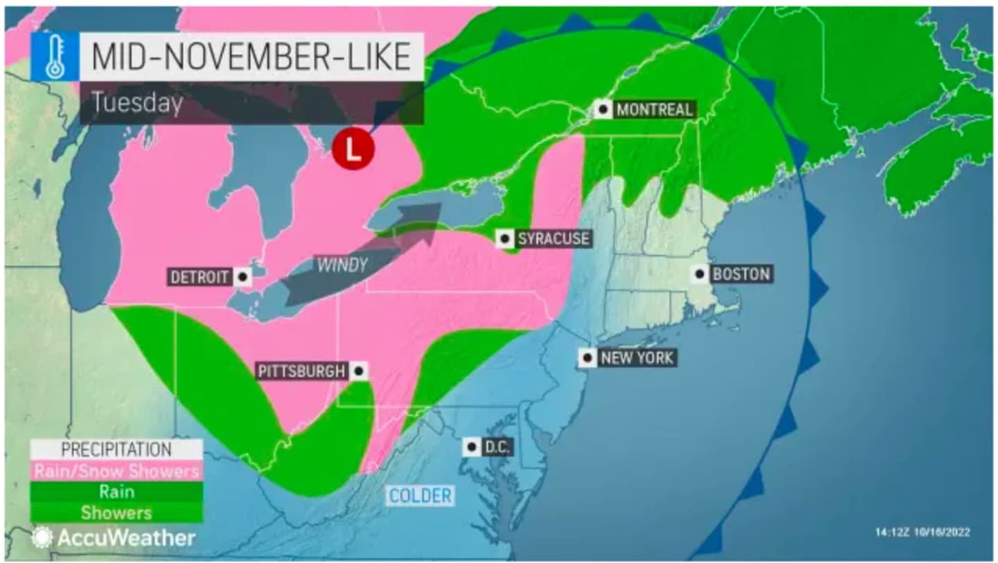
"The best chance for accumulations between a dusting and perhaps an inch or two will reside in the typical lake-effect snow belts in northwestern Pennsylvania and western and northern New York," AccuWeather Meteorologist Brandon Buckingham said.
An updated look at areas (shown in pink) where snow showers are possible on Tuesday is shown in the image above from AccuWeather.com.
Tuesday will become partly sunny with spotty showers possible throughout the day and a high temperature in the mid 50s.
Wednesday, Oct. 19 will become mostly sunny and clear with a high temperature in the low 50s.
Check back to Daily Voice for updates.
Click here to follow Daily Voice New Canaan and receive free news updates.