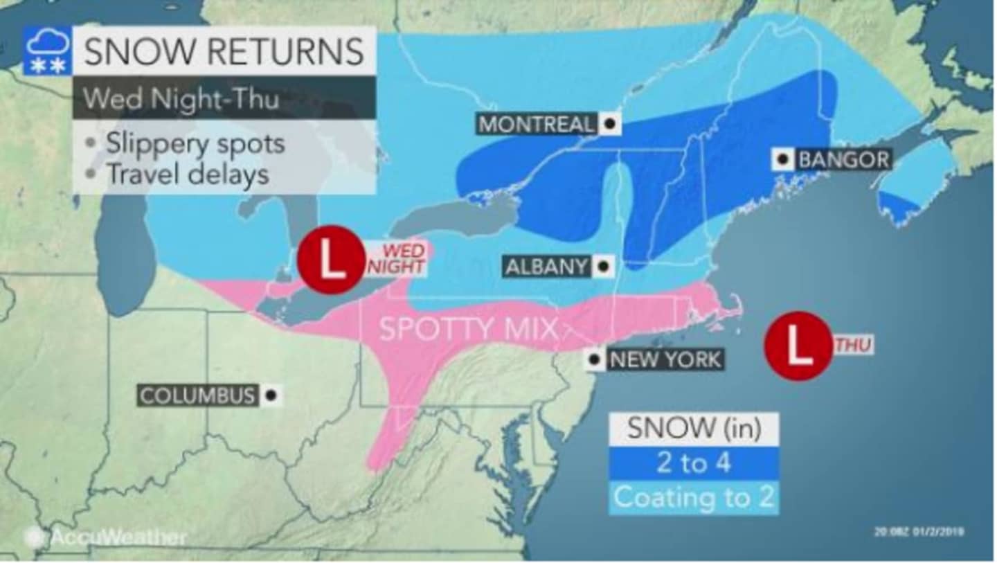
In the latest forecast by the National Weather Service, snow is now expected to start late Wednesday night, Jan. 2. In an earlier forecast, the projected arrival time had been around 1 a.m., Thursday, Jan. 3.
Snow is likely between 10 p.m. Wednesday and 4 a.m. Thursday, with about a half-inch of accumulation possible.
The new timing means the system is less likely to affect the morning commute.
There is still a chance of snow through 7 a.m. Thursday, but the chance between 4 a.m. and 7 a.m. is 30 percent.
Morning clouds will give way to sun in the afternoon with the high temperature rising to the mid-40s.
Friday, Jan. 4 will be mostly sunny with a high in the mid-40s.
A wintry mix is possible late Friday night into Saturday north of I-287 and the Merritt Parkway where the temperature will be at or below freezing. Southern parts of the area could see rain.
Check back to Daily Voice for updates.
Click here to follow Daily Voice New Canaan and receive free news updates.