
Here's the five-day forecast:
Saturday, Jan. 4: Steady morning rain will become more scattered with mainly light rain and drizzle in the afternoon. The high temperature will be in the low 40s.
There will be showers at times during the evening and in the early overnight hours. The low temperature will be around 34 degrees south of I-287 in New York and the Merritt Parkway in Connecticut. In some areas farther north and inland, there could be light snow overnight.
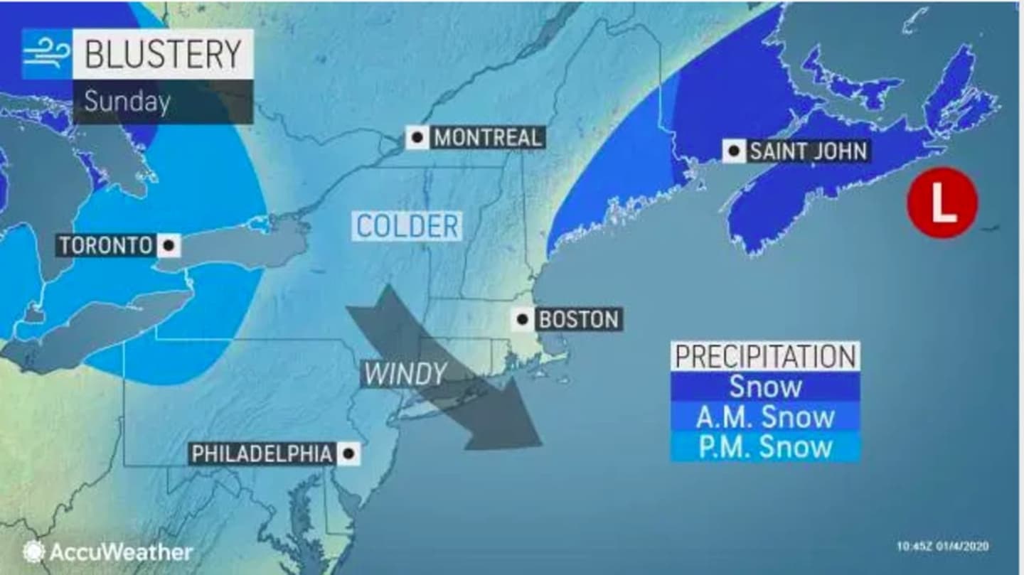
Sunday, Jan. 5: The high temperature will only be in the mid to upper 30s on a partly cloudy day. Wind out of the northwest at 16 to 21 miles per hour will make it feel like it's between 25 and 30 degrees.
The overnight low will be in the upper 20s with increasing clouds. A round of snow showers is possible overnight as the low temperature will be right around 30 degrees.
Monday, Jan. 6: There will be a slight chance of snow showers, mainly north and inland, through the morning commute before skies become partly sunny. The high temperature in the low to mid 40s, but the wind-chill factor will make it feel like its between 20 and 30 degrees. The overnight low temperature will be just below the freezing mark and in the 20s farther north.
Tuesday, Jan. 7: A more widespread snow event will begin Tuesday night into early Wednesday morning, Jan. 8.
Tuesday will start out partly sunny on a day in which the high temperature will be around 40 degrees. Clouds roll in around noontime, with rain likely after 2 p.m.
As the temperature falls during the evening, there's a chance of rain and snow, and become a wintry mix and snow becomes likely overnight with a half-inch to an inch of accumulation now expected.
The overnight low temperature will be around freezing and in the upper 20s farther north.
Wednesday, Jan. 8: Skies will clear in the afternoon with peeks of sun and a high temperature around 40 degrees. There will be a chance of snow showers farthest north and inland. before 10 a.m. It will be clear overnight with a low temperature around 30 degrees.
Check back to Daily Voice for updates.
Click here to follow Daily Voice New Canaan and receive free news updates.