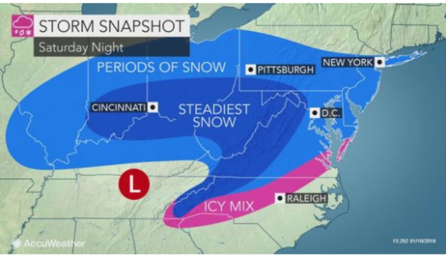
According to the latest projected track predictions, the steadiest snow will fall in the mid-Atlantic, with between 6 and 12 inches of accumulation possible in some spots. (See image above.)
There is still a chance the storm could strengthen dramatically and turn northward, but there is now just a 20 percent chance of snow overnight Saturday, Jan. 12 into Sunday, Jan. 13 for downstate New York and southern Connecticut.
Friday, Jan. 11 will be sunny with a high only in the upper-20s and a wind-chill value again between 5 and 15 degrees.
Saturday, Jan. 12 will be partly sunny and cold during the day with the high temperature reaching only 30.
The snow chance starts at around 11 p.m. Saturday.
The high temperature for Sunday will be just below the freezing mark with clouds giving way to sunny skies.
Monday, Jan. 14 will be mostly sunny with a high around the freezing mark.
Check back to Daily Voice for updates on the storm's track and strength.
Click here to follow Daily Voice New Canaan and receive free news updates.