

The time frame for the storm is a period of approximately 24 hours from Thursday, Dec. 22 to Friday, Dec. 23.
Heavy downpours could also lead to poor travel conditions, the National Weather Service said in a Hazardous Weather Outlook statement issued early Wednesday morning, Dec. 21.
A total of between 2 to 3 inches or more of rainfall is possible.
Millions of others, mainly in the Midwest, could see blizzard-like conditions.
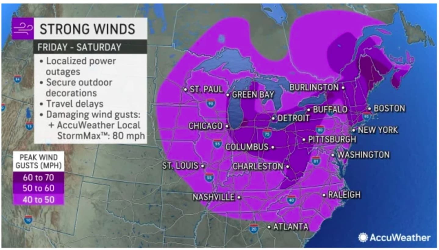
Widespread wind gusts on Friday will be between 40 and 50 miles per hour with gusts in some spots up to 70 mph. (See the first image above from AccuWeather.com.)
A look at areas expected to see rain (in green), rain mixed with snow (pink), and snow (blue) on Friday. (Click on the second image above.)
As the storm system moves off the coast, temperatures "will plummet from Friday afternoon to Friday night," according to AccuWeather.com, which noted that, "in some cases, a temperature drop of 30-50 degrees can occur in a matter of several hours."
"This is about as extreme of a temperature drop there can be in the Northeast," according to AccuWeather Senior Meteorologist Joe Lundberg.
The current outlook for Christmas Eve Day on Saturday, Dec. 24, and Christmas Day on Sunday, Dec. 25 calls for dry and brisk conditions, with mainly sunny skies, a high temperature only in the mid 20s, and wind gusts as high as 20 mph both days.
This continues to be a developing story. Check back to Daily Voice for updates.
Click here to follow Daily Voice New Canaan and receive free news updates.