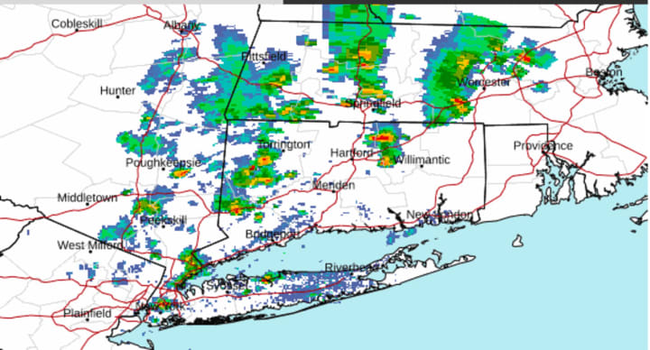
Storms developed in the mid-afternoon on Wednesday, June 28, with activity scattered across the region. (See radar image above.)
The storms, some of which are severe, are accompanied by heavy, brief downpours, rumbles of thunder, and lightning strikes.
Storms could pop up at times through the afternoon and into the early evening Wednesday before an unsettled weather pattern finally comes to a close, according to the National Weather Service.
Drier and warmer weather is expected Thursday, June 29, and Friday, June 30.
How much sunshine there is will depend on the amount of haze from wildfire smoke as more widespread poor air quality is expected as the plumes of smoke continue to push in an eastward manner.
Check back to Daily Voice for updates.
Click here to follow Daily Voice New Haven and receive free news updates.


