While the storm has now finally moved off the East Coast, the weather pattern will remain active through early next week.
After scattered morning snow showers, Wednesday will be mostly cloudy with some peeks of sunshine in the afternoon. It will remain cold, with a high temperature in the low to mid 30s, and wind-chill values between 15 and 20 degrees. Wind strength will be 10 to 15 miles per hour with gusts up to 25 mph.
There will be abundant sunshine for the first time in days on Thursday, Feb. 4, which will be sunny and breezy, with a high temperature in the mid to upper 30s and wind-chill values again between 15 and 20 degreees.
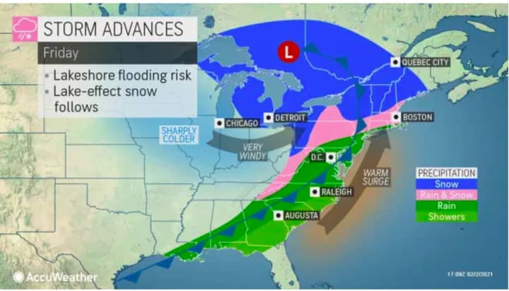
The next chance for snow will be on Friday morning, Feb. 5, with a mix of rain, snow, and freezing rain. Precipitation will become all rain in the afternoon as the high temperature climbs to around 40 degrees on a mostly cloudy day. (See first image above.)
Saturday, Feb. 6 will be mostly sunny with a high temperature in the low 30s.
There is a chance for another Nor'easter taking aim on the region, this one on Super Bowl Sunday, Feb. 7 into Monday, Feb. 8.
European forecast models have the storm following a similar track to this week's Nor'easter. American models have it moving farther north.
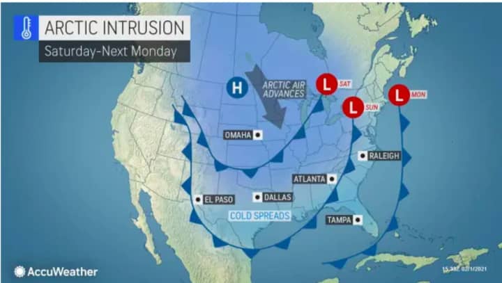
One thing is certain for now. Temperatures will allow for snowfall as an Arctic blast will return this weekend, lasting into early next week.
In fact, overnight lows on Sunday into Monday will only be in the upper teens.
It's too early to predict potential snowfall amounts as there is uncertainty surrounding the strength and path of the newest potential Nor'easter.
Check back to Daily Voice for updates.
Click here to follow Daily Voice Litchfield and receive free news updates.


