SHARE

Severe Thunderstorm Watch Issued For Area; Damaging Winds, Hail, Tornadoes Possible

A Severe Thunderstorm Watch has been issued for the entire region with storms now likely during the afternoon and evening on Wednesday, Sept. 4.

The Severe Thunderstorm Watch is in effect for the entire region until 9 p.m. Wednesday, Sept. 4.

The Severe Thunderstorm Watch is in effect for the entire region until 9 p.m. Wednesday, Sept. 4.

Photo Credit: National Weather Service
The New York metropolitan area could see Tropical Storm-force winds from Dorian on Friday, Sept. 6 and Saturday, Sept. 7.

The New York metropolitan area could see Tropical Storm-force winds from Dorian on Friday, Sept. 6 and Saturday, Sept. 7.

Photo Credit: NOA NWS National Weather Service
A look at the latest project path and timing for Hurricane Dorian, released Wednesday morning, Sept. 4.

A look at the latest project path and timing for Hurricane Dorian, released Wednesday morning, Sept. 4.

Photo Credit: NOAA NWS National Hurricane Center
The areas above are at risk for flooding, storm surge, damaging winds and power outages from Historic Hurricane Dorian.

The areas above are at risk for flooding, storm surge, damaging winds and power outages from Historic Hurricane Dorian.

Photo Credit: AccuWeather.com

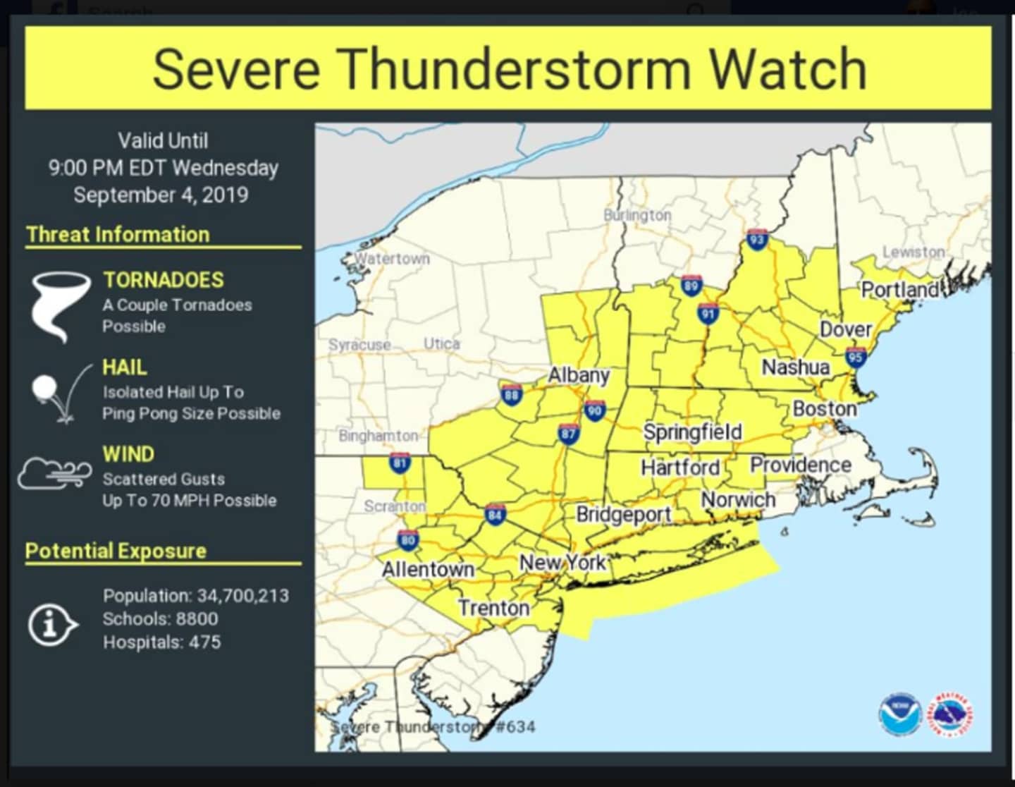
The main threat will be strong, damaging winds and hail, the National Weather Service said. A couple of tornadoes are also possible. (See first image above.)

The watch went into effect just before 1 p.m. Wednesday and lasts until 9 p.m. Wednesday.

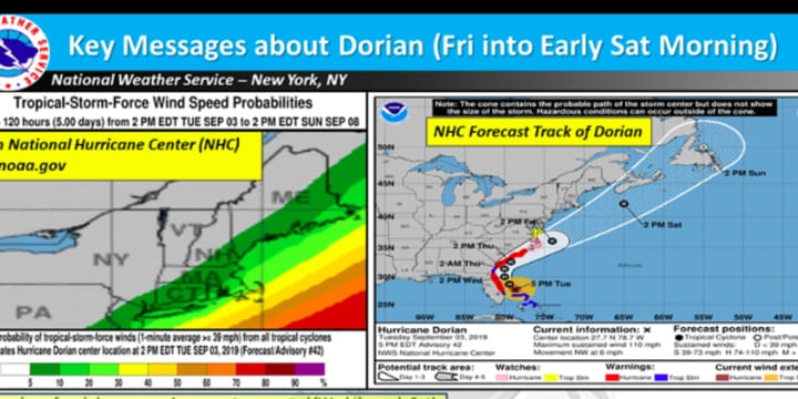
After a pleasant day on Thursday, Sept. 5 with sunny skies and a high temperature in the upper 70s, the New York metropolitan area is in the range for Tropical Storm-force winds from Dorian on Friday, Sept. 6 into Saturday, Sept. 7. (See second image above.)  

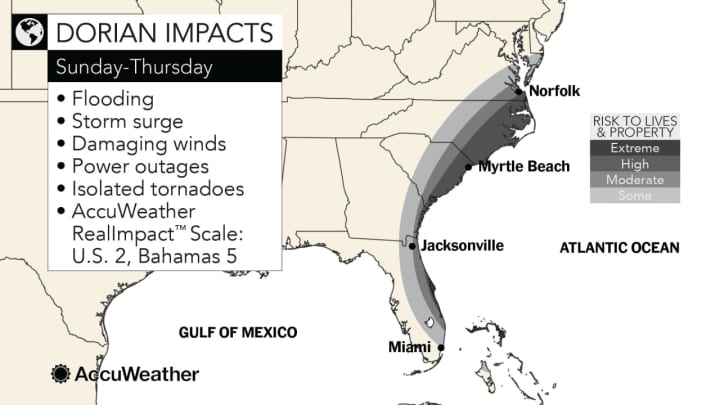
The National Weather Service said it now has increased confidence of rough surf and dangerous rip currents in this area through Saturday.

Friday will be mostly cloudy with a high temperature in the low 70s. Rain is possible Friday afternoon and will become likely Friday night.

Dorian is expected to finally push off the east coast Saturday, which will be a pleasant day with mostly sunny skies and a high temperature in the mid 70s.

Check back to Daily Voice for updates.

to follow Daily Voice Greenwich and receive free news updates.

SCROLL TO NEXT ARTICLE