Damaging winds will kick in early in the afternoon on Friday, Feb. 7 with gusts as high as 50 to 55 miles per hour.
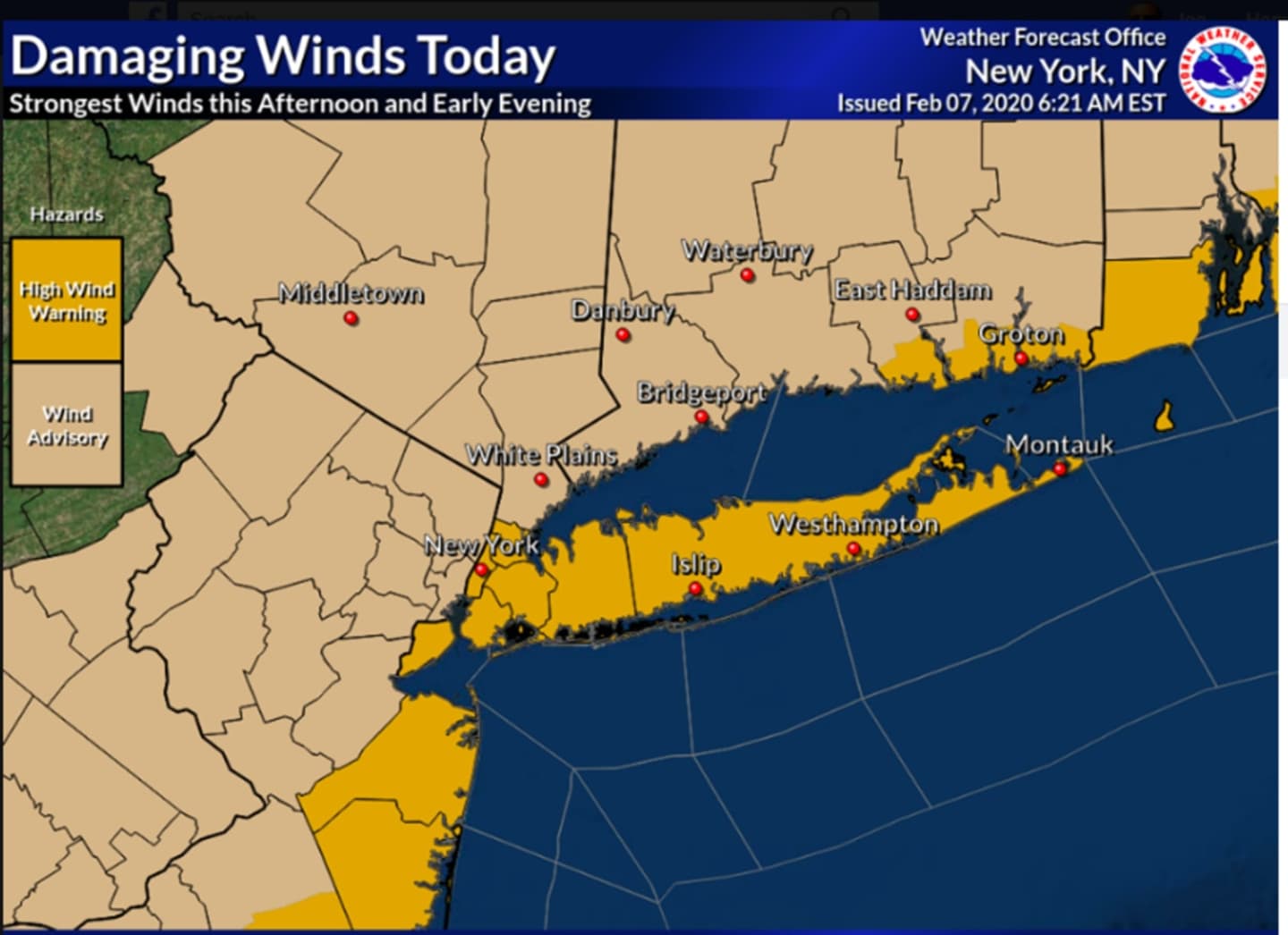
Wind Advisories have been issued for most of the region with High Wind Warnings in effect for New York City and Long Island from noon until 7 p.m. Friday. (See image above.)
Tree limbs could be blown down, leading to isolated power outages.
After the high temperature climbs to the low 50s around noontime Friday, there will be a plunge of about 10 degrees by late in the afternoon.
Rain will start to taper off early in the afternoon, but there is a chance of precipitation through 4 p.m.
As the temperature plummets during that time, and with wind-chill values between 25 and 35, some spots north and inland could see a bit of light snow at times. Little or no accumulation is expected.
Winds will calm Friday evening, but it will become blustery and the overnight low temperature will dip all the way down to the mid to upper 20s with wind-chill values between 15 and 25 degrees.
Saturday, Feb. 8 will be sunny but cold with a high temperature in the low to mid 30s north and inland with wind-chill values between 10 and 20 degrees. Farther south, Saturday's high will be near 40 degrees with the wind-chill factor between 15 and 25.
Check back to Daily Voice for updates.
Click here to follow Daily Voice Darien and receive free news updates.