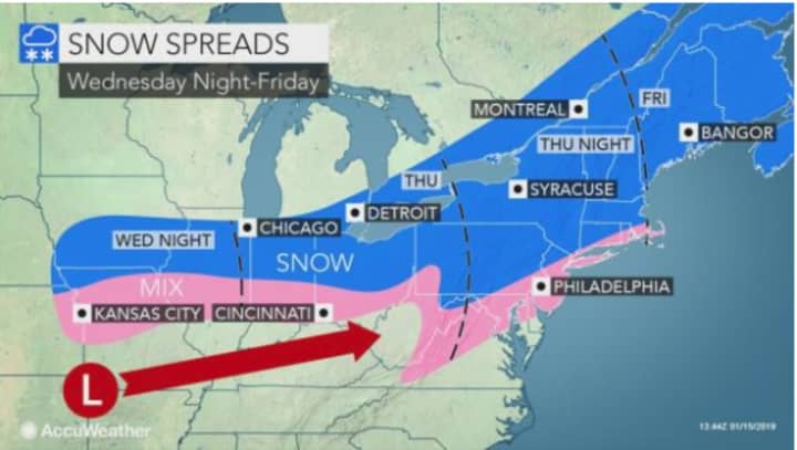
Get set for back-to-back storms that will make it look and feel like it really is the middle of January.
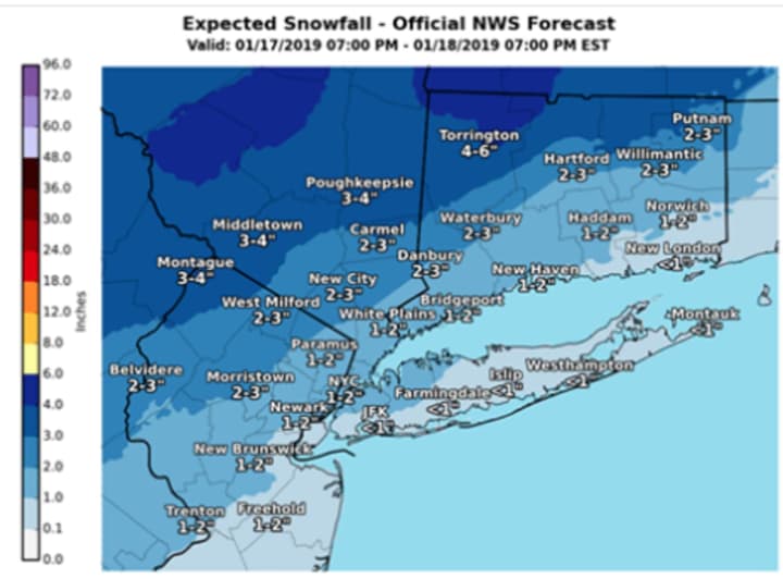
The first storm will come overnight Thursday night into Friday morning with widespread 1 to 4 inches of accumulation, with the higher amounts farther north. For the latest snowfall projections, see the third image above.
Travel will be hazardous due to poor visibility and snow-covered roads, particularly across the interior for the Friday morning commute, the National Weather Service said.
Snow is expected to arrive around 11 p.m. Thursday and continue overnight before changing to a mix of rain, snow and freezing rain. Precipitation will end by around 10 a.m. Friday, Jan. 18.
The rest of the day will be cloudy with a high temperature climbing to around 40 degrees.
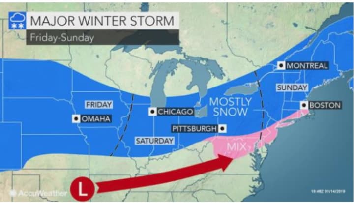
Then, get ready for Round 2 as a more significant storm the National Weather Service describes as "multi-hazard" comes this weekend.
The major storm is expected to arrive after 4 p.m.on Saturday, Jan. 19 on a cloudy day with the high reaching the mid-30s.
Snow will mix with rain and sleet at times, and the storm could last 24 hours through Sunday night, Jan. 20, with the system wrapping up with evening snow showers. Up to 6 to 12 inches of snow accumulation is possible, although there is still some uncertainty about the strength and exact track of the weekend storm.
"It's too early for exact (snowfall) amounts, but it looks to bring heavy snow accumulations, wintry mix (sleet/freezing rain) to some followed by very cold air, strong winds and possible dangerous wind chills Sunday night into Monday," the National Weather Service said.
Martin Luther King Jr. Day, Monday, Jan. 21, will be mostly sunny and frigid, with a high of only about 20 degrees.
This continues to be a developing story. Check back to Daily Voice for updates.
Click here to follow Daily Voice Danbury and receive free news updates.


