A warm front has arrived along with the start of the workweek, bringing. That front will bring showers, rain and thunderstorms for the next 24-plus hours. Downpours at times could cause flooding in some spots.
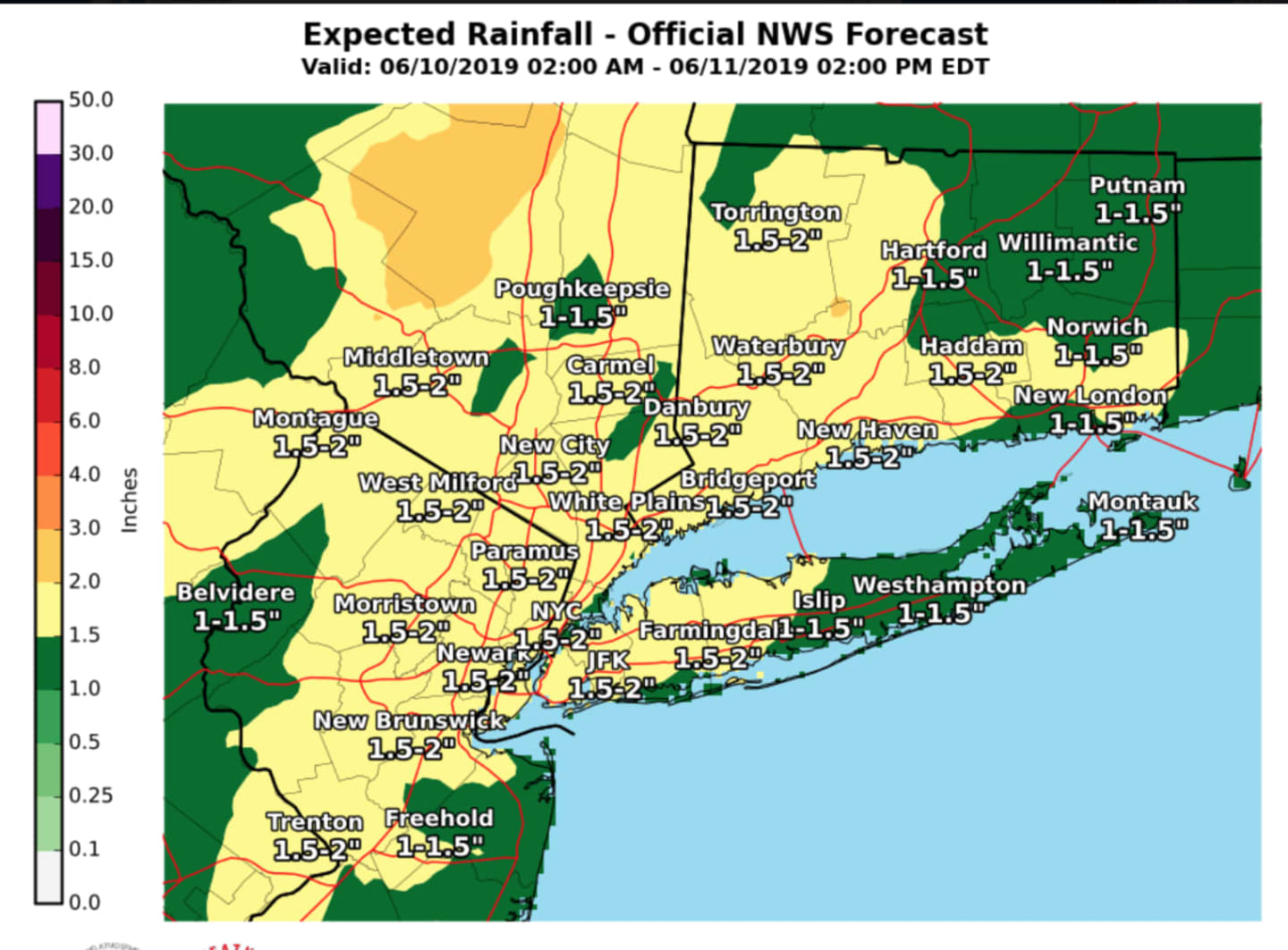
Most of the area will see about 1.5 inches of precipitation before the system moves out. For a look at projected rainfall totals from Monday, June 10 through early Tuesday afternoon, June 11, check the image above.
Here's the outlook:
Monday, June 10: Mostly cloudy and rainy, with a high temperature around 70 degrees. Showers, rain and thunderstorms become likely after noontime and continue at times during the day and evening. Up to three-quarters of an inch of precipitation is possible.
Tuesday, June 11: Overnight showers and thunderstorms will continue through around noontime. Skies will gradually clear later in the afternoon. The high temperature will be near 75 degrees. Expect another half-inch to an inch of precipitation.
Wednesday, June 12: Mostly sunny with a high in the low 70s.
Check back to Daily Voice for updates.
Click here to follow Daily Voice Brookfield and receive free news updates.