The time frame for the system expected to move through the Great Lakes and into the Northeast is from the middle of Tuesday afternoon, July 12 into Tuesday evening.
Monday, July 11 will be dry and sunny ahead of the system, with a high temperature in the low to mid 80s, according to the National Weather Service.
Tuesday will start off partly sunny before the chance for storm begins after 2 p.m. It will be a warmer and more humid day with a high temperature in the upper 80s.
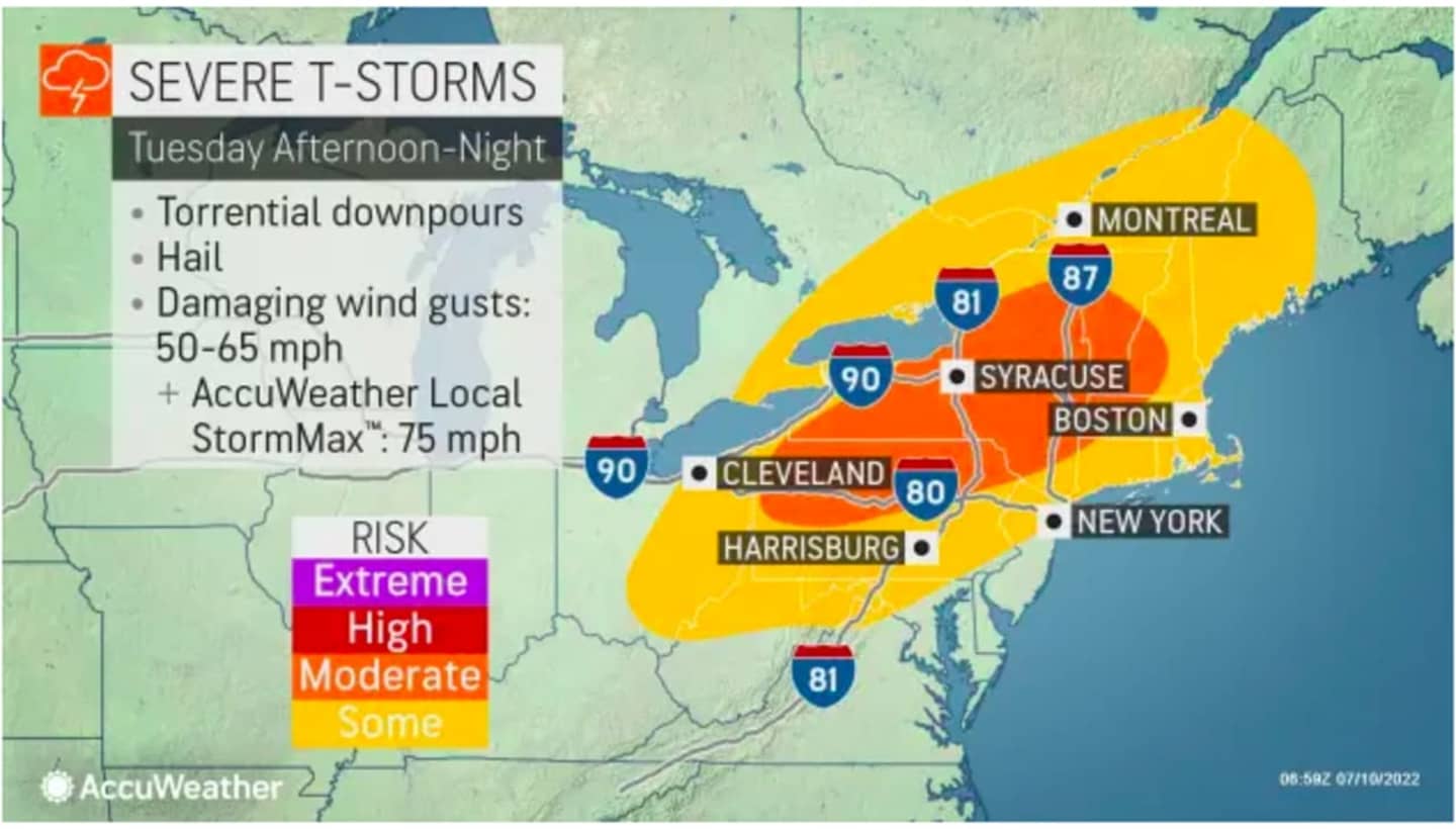
The chance for showers and storms will increase Tuesday night. Some wind gusts could be as high as 75 mph (see the image above).
After the system passes through late Tuesday evening, Wednesday, July 13 will be mostly sunny and warm, with a high temperature of around 90 degrees.
There's a slight chance of pop-up showers and thunderstorms in the mid-afternoon on Wednesday.
Thursday, July 14 will be mostly sunny with a high temperature in the mid 80s. There will also be a chance for showers and thunderstorms in the afternoon.
The outlook for Friday, July 15 calls for mostly sunny skies and a high temperature in the low to mid 80s.
Check back to Daily Voice for updates.
Click here to follow Daily Voice Brookfield and receive free news updates.