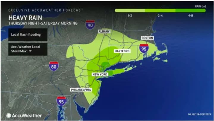
In those areas, heavy rainfall is likely with the potential of scattered to numerous areas of flash flooding during the day Friday, Sept. 29, into Friday night, according to the National Weather Service.
A widespread 3 inches of rain is now expected from the slow-moving storm, with locally higher amounts of 4 to 6 inches, an increase over earlier projections.
Areas in the darker shades of green in the first image above will see the heaviest rain.
There will also be scattered thunderstorms with thunder and lightning.
A Flood Watch is in effect for much of the area until 6 a.m. Saturday, Sept. 30.
"This round of rain will at the very least cause travel delays Friday into early Saturday, with the potential for serious flash flooding in areas from New York City up to near Boston," said AccuWeather Meteorologist Dean DeVore.
Friday's high temperature will be in the low 60s.
Rain will linger into Saturday morning with scattered showers in the afternoon on a mostly cloudy day. The high temperature will be in the mid-60s.
Dry and mild weather will return for the second half of the weekend on Sunday, Oct. 1 which will be sunny with the high temperature climbing to the mid-70s.
Check back to Daily Voice for updates.
Click here to follow Daily Voice Brookfield and receive free news updates.


